Now that I knew where to find the first legs of the local acequia, my next step was to trace the Santa Cruz river back to the diversion point. I began where the Santa Cruz enters the Rio Grande just north of the Griego Bridge in Española. Except at the water’s edge, where mechanical equipment can’t go, the land there’s been kept barren. It’s on the perimeter of a toxic dump site that’s actively being remediated.
The next place up stream I knew I could see the Santa Cruz was at the Riverside Drive (route 68) bridge. There the banks are more defined, perhaps because there’s no back flow from the confluence with the Rio Grande to erode them.
Immediately upstream, the river recovers its natural vegetation pattern, or at least the one that has come back and been left relatively undisturbed.
From there I drove into the first large commercial parking lot I found on the east side of the road. Behind the business, a large area had been scraped bare of any vegetation. Behind that wasteland, some cottonwoods had come back.
Beyond the trees, I found the river, apparently far enough away from any building that its course was left unmanaged. It had carved itself a winding path through sedimentary soils that varied by deposition, avoiding rocks where it could, eroding softer areas at will.
The depth was controlled by dams upstream, but the bottom was still littered with river rock.
I tried another parking lot, a bit farther upstream, where the grasslands before the cottonwoods were less disturbed. I could see houses through the trees that had to be on the other side of the river. However, a well-maintained chain link fence kept me confined to the parking lot.
There was one parking lot left to try before the highway started its climb out of town. The land owners there were definitely tired of people confusing their drive with a public road. There could be no explanations of innocence if I went down that road lined on the right by cottonwoods.
I’d seen as much as I was going to see of the left bank of the Santa Cruz.
Photographs:
1. Santa Cruz river just before it enters the Rio Grande, 29 December 2011.
2. Santa Cruz river just before it goes under highway 84/285, 20 January 2012.
3. Santa Cruz river upstream from 84/285, 20 January 2012; red sandbar willows marks the banks of the river.
4. Approach to Santa Cruz river from behind a business on 84/285, 20 January 2012.
5. Santa Cruz river behind a business on 84/285, 20 January 2012.
6. Santa Cruz river behind a business on 84/285, 20 January 2012.
7. Santa Cruz bosque behind a second business on 84/285, 20 January 2012.
8. Gate blocking access to the Santa Cruz behind a third business on 82/285, 20 January 2012.
Saturday, February 11, 2012
The Ditch - The Left Bank
Friday, February 10, 2012
The Ditch and the Highway
Design decisions by road engineers are not intuitive. You’d think they’d find the easiest route through terrain that changes level because it would be the cheapest, require fewer technical skills and less heavy equipment. Politics and population density, of course, always override those factors.
The route of 84/285 into Española is a puzzle. According to the area USGS map, the highway is just down from a 5750' gradation line on a great Tertiary mound that immediately rises another 25' on the one side and drops 25' on the other.
Why did they chose that path when it required moving so much dirt, then stabilizing the banks on both sides? In addition, they had to put that dirt somewhere. At least some of it was pushed on down the road toward the Santa Cruz river, because several of the surviving houses along the highway near the river crossing are way below the grade of the road.
There had to be some problem with that lowland alluded to by the use of checkered green squares on the map that made it more difficult to use than cutting through a great pile of unstable rock and sand.
I drove that stretch of road looking for some safe way to see the lower land. Most of the drives in that direction were private and looked steep enough to require a mountain goat to scale in bad weather.
When I did find one, I was totally surprised. About half way down the bank I saw the concrete banks of the local acequia.
Even more surprising, when I looked out over the lowlands I saw the rear addition of Iglesia de la Santa Cruz de la Cañada.
This section of road was just over a mile southwest of the village of Santa Cruz. The red line in the middle ground was the Santa Cruz river because those trailers are on the other side. Here was the river near my feet, not somewhere way north.
I started walking upstream along the ditch and discovered something else. Water from the highway was channeled into it. This means that, in an especially heavy storm, water from 84/285 is dumping into the near and far arroyos, digging those bottoms even deeper.
I stopped when I got to someone’s territorial marker, one that may have dropped accidentally, but deliberately hadn’t been cleared.
I looked beyond the tree. The ditch turned toward the river and began to go downhill. Down hill.
When I got home I looked more carefully at a map to see how I could have such a wrong idea about the course of the Santa Cruz river. The men who built the modern road from the Roman Catholic village of Santa Cruz to the Rio Grande made even more puzzling decisions than those made by the state engineers. Route 76 follows the river for a short time, then turns northwest to give the illusion the village is to the north.
It doesn’t meet 84/285 near the commercial area that developed around the Oñate bridge and the railroad, but comes out in what must have been comparatively empty land south of what was once a Mormon settlement at Fairview. Only a car would go there; not a man walking or driving an animal.
Photographs:
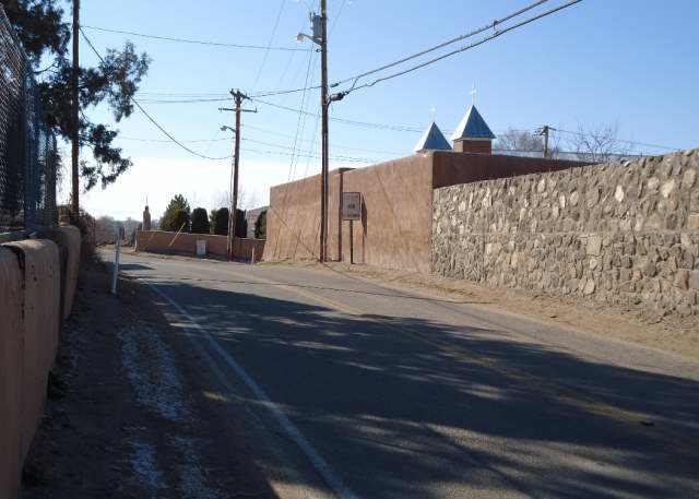
1. Road cut on 84/285 coming into Española, 27 January 2012.
2. Local acequia below 84/285, 3 February 2012.
3. Back of Iglesia de la Santa Cruz de la Cañada from the bank below 84/285, 3 February 2012. The line of red crossing the midground is sandbar willow growing along the Santa Cruz river. I drove over; those trailers are on the other side of the river. Santa Cruz badlands are in back.
4. Drainage for water from the highway dumping into the acequia, 3 February 2012.
5. Tree across the local acequia, 3 February 2012.
6. The local acequia turning in the direction of the Santa Cruz river, 3 February 2012; the fallen tree is in the center.
7. Intersection of Santa Cruz Road (route 76) with Riverside Drive (route 68).
Thursday, February 9, 2012
The Ditch - Port of Entry
A highway created my view of the local landscape, a road that’s not even the original one that connected the colonial capital of Santa Fé with the Spanish settlement of Santa Cruz and the northern pueblos. According to the 1940 WPA Guide to 1930's New Mexico that road originally went through Santa Cruz, but was moved west “a few years ago.”
It was moved to speed tourists between Santa Fé and Taos who were impatient with the twists and turns of roads built for ox carts. When gas stations and stores and homes sprouted along the new road, 84/285 became a bottleneck made worse by drivers more intent on turning into badly graded parking lots than maintaining the flow of traffic. The need to watch them makes it difficult to notice the twists in the road.
My image of the road from Pojoaque, described in a posting for 3 November 2011 on the “Santa Fe Group,” was that it went through Tertiary sediments laid down, after the Velarde half graben dropped, but before the Rio Grande existed, from debris washed down from the Peñasco Embayment north of the Picuris river. Animal fossils date to the Miocene Barstovian period of 14 to 15 million years ago.
To understand how Arroyo Seco could possibly cross my local ditch, I had to imagine what the land was like before those sediments were disrupted and rearranged by faulting events. I tried to think of the area as a rolling plain with the Santa Cruz river, Arroyo Seco and Pojoaque Creek flowing down from the Sangre de Cristo. The bones of extinct large mammals have been found in the badlands near those ancient rivers.
This week, I drove down to the Nambé exit north of Pojoaque and came back trying hard to see through the dramatic present to the past when the arroyo first carved its bed.
Route 84/285 rises some 125' as it leaves the -5825' valley of Pojoaque Creek to peak somewhere around -6000' west of a 6073' peak called Nambé on the USGS map. In a quarter mile, the road angles left and begins its descent into the valley of Arroyo Seco. It’s crossed the watershed between the two waterways.
For a short distance it levels around -5925' with a wide open space to the right. This is where those feeder arroyos are flowing somewhere out of sight in the hills.
Within a mile, the road is forced east by the intrusion of a -6000' pile of sediment, something you would expect if you were following a river through the herringbone pattern of alternating east and west ridges. This is just before the tributary arroyos reach the main one.
From there the highway goes left again, and drops to the valley floor at roughly 5725'. The tributaries have now joined Arroyo Seco and it becomes visible from the road. It’s banks are low. The alluvial soils must be so soft, what water flows through there simply spreads.
From there it flows west as described in the previous post.
Note: Elevations are estimates based on the USGS map. It’s quite possible I’ve misread the gradation lines in places. These maps are not my area of expertise.
Photographs:
1. McCurdy Road near Iglesia de la Santa Cruz de la Cañada,7 February 2012. There are no shoulders and no passing room between walls that block the view of curves.
2. Los Barrancos on the west side of 84/285, north of Pojoaque on Pojoaque pueblo land, 2 November 2011.
3. East-west ridge you cross on 84/285 as you enter the Arroyo Seco valley from Pojoaque, 2 November 2011; view to the east.
4. Arroyo Seco valley to the east from route 84/285, 2 November 2011.
5. 284/285 getting ready to swerve around the formation on the west, 2 November 2011.
6. Arroyo Seco from Bar D Four Road looking south, 6 February 2011; 84/285 is the grey line behind the trees.
Wednesday, February 8, 2012
The Ditch - Arroyo Seco
When I found that main part of the local acequia, I followed the banks a little upstream only to discover it turned toward the badlands that exist by my house.
I looked in the other direction and saw a huge mound of dirt, some 80' high, behind an arroyo bridge.
My mental map was shattered. The ditch was heading south when I believed its source was to the north. I’d gotten that idea from driving though Española.
After you cross the bridge on 84/285 where the Santa Cruz river turns to enter the Rio Grande, you drive three-quarters of a mile along the Rio Grande to reach route 76 that goes to the village of Santa Cruz. From there, it’s more than a mile to McCurdy Road and the church. You don’t actually see the river until you’re on your way to Chimayó.
I always assumed the Santa Cruz river got to the bridge the same way I did.
Suddenly I realized, if the ditch did come from the north, it had to get around that mound and cross an arroyo where there’s no sign of a flume. With everything I believed in disarray, I repeated a mantra from the laws of physics.
Water does not flow uphill.
Water does not fly.
Water does not flow uphill.
Water does not fly.
I couldn’t believe that arroyo near the ditch was the source of the acequia. It’s just too insignificant. It almost never has any water in it, even after a hard rain. The banks are low, the bottom wide. There’s no way it could be feeding the water that carved the high banks of the far arroyo, unless there’s some dam hidden somewhere.
Maps show the red bridge crosses the Arroyo Seco. I never connected the arroyo I cross daily with the Arroyo Seco near the highway to Pojoaque and Santa Fé. Dry Ditch is an even more common name than Black Mesa.
I just assumed the one on 84/285 meandered off west somewhere toward the Rio Grande after it passed under the road at the La Puebla exit. After all, it’s impossible to see north of Boneyard Road, the next road going west. Even when the camera’s zoom lens is pushed beyond its limits, the arroyo is nearly invisible.
Between Boneyard Road and the approach to Española, small, commercial buildings block the view to the west. In that stretch, there can be no arroyo because there is no landscape.
The other arroyo, the one on the side road, has always simply existed as some primordial presence. If I ever thought anything, it was that it formed from drainage from the immediate badlands.
I realized when you’re driving to some destination, the passing landscape is merely a backdrop that’s changed between the different scenes of your life. There’s no continuity in stage setting because there’s no mental connection between where you pass during the week on your way to work and where you go shopping on weekends.
But, of course, continuity exists outside one’s experience, and there is only one Arroyo Seco in this area. The USGS map for the Española quadrangle shows it forms from three intermittent creeks that flow north through those hills to the east of 84/285 north of Pojoaque. Each of those has two branches. There’s also one short tributary coming from the north.
They merge with another arroyo coming from the east into a northwest tracking sand bed.
Soon after, the arroyo goes under the road before the La Puebla exit, parallels 84/285 for a short distance then continues to flow between the badlands and the mound before if somehow intersects the ditch.
It is the same arroyo. There is no secret dam holding back water for the acequia. Its two appearances, on two different roads, create the illusion of bifurcation.
Photographs:
1. Local acequia heading back toward the distinctive badlands formation, 20 January 2012.
2. High mound of Tertiary sediment behind the red side road bridge that crosses Arroyo Seco, 7 February 2012.
3. Arroyo Seco on the other side of the red bridge, 6 February 2012; there is no flume visible.
4. Arroyo Seco disappears before the boundary between private land on Boneyard Road and Santa Clara pueblo land, 7 February 2012. It’s probably that band of sand on the left below the buildings. Color is distorted by the camera’s overextended zoom lens.
5. Arroyo Seco reappears as the sandy streak below the badlands looking west from the 84/285 access road, 7 February 2012. The feeder was probably created by drainage from the highway.
6. Arroyo Seco before the white La Puebla exit bridge, 6 February 2012; highway is on the left.
7. Arroyo Seco downstream from the distinctive badlands formation and before the bridge shown above, 6 February 2012; there is no flume visible.
Monday, February 6, 2012
The Ditch - The Great Temptress
The snow from December 5th lingered, then turned to ice, then to mud. At first I didn’t go walking in the far arroyo because I couldn’t see the ground, then because the paths around my house were too treacherous, then because my drive was too mucky.
Just before Christmas I felt so confined I walked farther down the paved road by my house than I ever had before. Then, the middle of January, I walked even farther, down to the second of the three arroyos I cross to get home. The far arroyo is in the other direction.
The mud and ice got worse. I finally got in the car and drove down the road looking for some place to walk. I parked in an area where I’d seen people leaving their cars and headed back to the second arroyo. Then, I noticed women were parking a bit farther down the road to walk their dogs.
There the adventure began. They were threading the banks of the main ditch that feeds my area. I followed the banks to the end of the undeveloped land and back, an area I had passed on the road a few days before.
I suddenly wanted to know more about the ditch. I’ve been here twenty some years and knew bits and pieces. Last fall, in a walk described on October 22, I found the end. Now I wanted to know the beginning, its twistings and turnings, its ways of delivering water. I wanted to know how it got from the Santa Cruz river to the far arroyo, I even wanted to know the origins of the Santa Cruz.
I chased it in pieces, beginning in the middle as one does with so many things in life, and now, like the aging person I am, I’m trying to make sense of what I’ve seen.
Photographs:
1. Ice in the main path to my house, 18 January 2012.
2. The second or deep arroyo, 11 January 2011; comparing the two story house at the back and the tops of the saplings gives some idea of the depth of this arroyo.
3. The local ditch or acequia, about four miles from my house, 20 January 2012.
Monday, January 2, 2012
Calendar
It’s time to buy a new calendar and I’m suddenly faced with another of retirement’s changes. I no longer need one.
That is, I no longer need a weekly one where I log my hours and list deadlines. I’ve had one since I was a college freshman. For years they where desk sized with pictures for every week. Then, when I went to work and had to carry it with me, they became pocket sized with no ornamentation.
Now a monthly one will do to remind me of my few appointments, mostly medical in nature. Indeed, since I no longer need to pull it out every day, a monthly one will be better at reminding me that something in the future is lurking somewhere on the page.
I wouldn’t even have to spend money if card shops still had those free ones they used to. But that would rob me of the pleasures of calendar hunting, one of those rituals of the new year. I’ve found some pocket sized ones with pictures, not as wonderful as the desk sized weeklies, but something still more aesthetic than utilitarian.
This could be a new market for those selling to the coming retirement class - only most of those, at least those who use calendars, probably carry their’s on their telephone, and won’t exchange that continuity with the wired world for mere paper. After all, aging shouldn’t be a time of regressing.
That is, I no longer need a weekly one where I log my hours and list deadlines. I’ve had one since I was a college freshman. For years they where desk sized with pictures for every week. Then, when I went to work and had to carry it with me, they became pocket sized with no ornamentation.
Now a monthly one will do to remind me of my few appointments, mostly medical in nature. Indeed, since I no longer need to pull it out every day, a monthly one will be better at reminding me that something in the future is lurking somewhere on the page.
I wouldn’t even have to spend money if card shops still had those free ones they used to. But that would rob me of the pleasures of calendar hunting, one of those rituals of the new year. I’ve found some pocket sized ones with pictures, not as wonderful as the desk sized weeklies, but something still more aesthetic than utilitarian.
This could be a new market for those selling to the coming retirement class - only most of those, at least those who use calendars, probably carry their’s on their telephone, and won’t exchange that continuity with the wired world for mere paper. After all, aging shouldn’t be a time of regressing.
Sunday, January 1, 2012
A Watershed
Sometimes a watershed is more than a parting of the waters.
This week I drove southeast from Santa Fe toward Clines Corners on route 285. After passing the rump end of the Sangre de Cristo, the road passes through the Galisteo basin where grasses spread from both sides of the road.
Then, volcanic debris reappears with juniper trees. I stopped somewhere near mile marker 268 where an open expanse of four-winged saltbush outlined what must have once been flood land.
Snow from last week’s storm still veneered the land, but didn’t cover the taller plants. A few black cattle were visible in the distance. It was considered range land.
Just a few miles down the road glazed snow spread to the horizon. Shrubs were half-buried. The wind picked up. Just beyond Clines Corners plows were out keeping the right lane to Vaughn cleared from blowing snow.
When I drove back I noticed a sign somewhere between the two points where I’d stopped to take pictures that indicated I had crossed into the Galisteo watershed.
Apparently, this didn’t just mark the boundary between the volcanic Rio Grande valley and the great plains. It denoted a change in climate as well.
Pictures taken 29 December 2011 on route 285. Top taken about mile marker 277. Second around mile marker 268. The others near mile marker 263, less than five miles away.
Labels:
Climate,
Galisteo Basin,
Great Plains,
New Mexico
Subscribe to:
Posts (Atom)