Showing posts with label White Rock Canyon. Show all posts
Monday, October 31, 2011
Lakes
The morning of the day the Las Conchas fire started, the air was so hot, the soil so dry I went looking to see if any prickly pear were blooming anywhere this season.
One place I walked was an open field just beyond the near arroyo. Nothing. Not a flower, hardly a healthy plant in a place they bloom year after year.
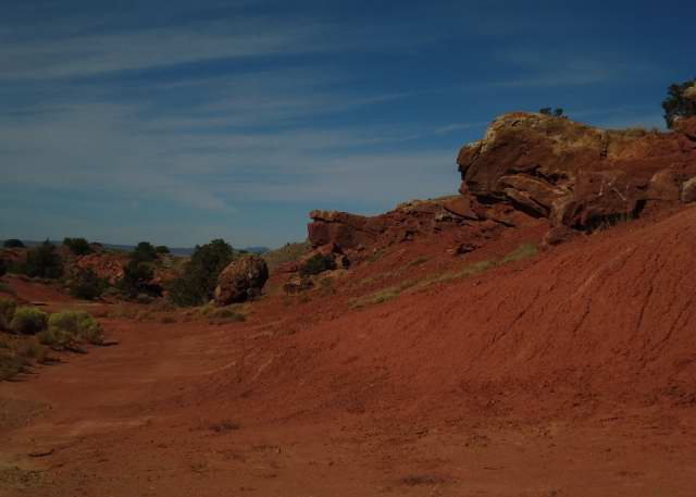
The Pacheco fire was still burning towards Tesuque and was sometimes visible from the road in the area. I looked that way from somewhere in the center of the field and, besides smoke, saw something I’d never noticed before. The field looked like a great bay that water had washed over from a break in the badlands.
Saturday, when I was in the near arroyo, I wondered how it connected to that open space which it had to border somehow. The bed narrows between five or six foot walls a little beyond the point where water begins channeling itself for the culverts. As I went up stream from there, it turned to the left and suddenly opened into a great, wide expanse with almost no banks.
I remembered something similar in the far arroyo. Yesterday I walked back to refresh my memory. Again, the tall walls make a turn, this time to the right, and a great expanse opens.
I came home to pour over Daniel Koning’s map of the Española quadrangle and I noticed something I’d missed before, that some of the places I’d read as Qay1 were really Qayi.
Qay1 is his code for alliuvial soils laid down in the first phase of the post-glacier Holocene period. The river bottom is Qay2, a younger layer.
Qayi turns out to be some intermediate phase of sand and gravel bands, the very strata I’d noticed along some of the taller walls in the far arroyo. The same pattern appeared in the shallow walls of the great expanses of both arroyos. This is precisely where he’d marked Qayi on the map.
Some passing reference in Ted Galusha and John Blick’s article on Española sedimentation that I’ve slowly been reading sent me to look up the Otowi lava flows they said had dammed the Rio Grande in recent times.
I discovered Steven Reneau and David Dethier’s work on area lakes created when landslides dammed the Rio Grande around the Otowi bridge. One occurred around 43 thousand years ago and created a lake some 15.5 miles long that lasted anywhere from a hundred to a thousand years.
Another landslide created a pool 13 miles long about 17.5 thousand years ago which broke suddenly. The most recent, formed about 12.4 thousand years ago, was also about 15.5 miles long and filled completely with layers of sediment.
During much of this time, the very end of the Pleistocene, there was greater rainfall than now, so the river levels would have been higher. The most recent lake was 100' deep.
This area is well within 10 miles of the Otowi bridge, probably much closer if you’re a crow or a drop of water.
One small mystery has been solved, the origin of those gravel bands. What still is unknown is why the channels that are being opened now in the arroyos and washes were there to be filled by Qay1 and Qayi in the first place.
Labels:
Era Holocene,
Era Pleistocene,
Era Quaternary,
Española,
Geology,
Las Conchas Fire,
New Mexico,
Otowi Bridge,
Plants,
Rio Grande,
White Rock Canyon
Sunday, October 16, 2011
La Bajada
How do you know a book is fraudulent?
When it purports to give a driver an explanation of all the important geological features visible from a car, and, in the section on I-25 from Albuquerque to Santa Fe, doesn’t mention La Bajada Hill.
The La Bajada escarpment rises some 800' from the Santo Domingo basin. The first road, built by the army in the 1860's, had some 28% grades. When the last territorial governor, William Mills, had a better road built in 1910, it had 23 hairpin turns or switchbacks to make the mile and half climb with a maximum 7.8% grade. Railroads then couldn’t handle more than 3%.
Fraudulent may be too strong a term for a book that does provide some useful information, but La Bajada’s not something you can miss if you’re driving south from Santa Fe. You do wonder if the author ever made the drive.
The city was founded in 1610 by Pedro de Peralta as a safer, perhaps better watered, alternative to the Española valley. It was conceived as a citadel.
To get there from the river you had to scale the walls of White Rock Canyon. To get there from the north you had to climb what we now call Opera Hill from the Tesuque valley. To get there from the east you had to cross the Sangre de Cristo. To get there from the south you had to come up La Bajada from the Galisteo river.
The Atkinson, Topeka and Santa Fe Railroad refused to come. It’s engineers skirted the Sangre de Cristo to find an opening to the south. To pacify the local politicians they built a station at Lamy and left it to them to get their goods uphill.
Route 66 originally climbed the hill, but was the source of great complaint by Fred Harvey’s organization who wanted to give rail passengers local tours on buses. When governor Arthur Thomas Hannett suggested rerouting the road from Santa Rosa to Albuquerque, merchants in Santa Fe protested. He was not re-elected in 1927. In the remaining month of his term the former member of the State Highway Commission had the Santa Rosa cutoff built anyway.
The present La Bajada road was built in 1932 three miles east of the original, and later improved for the interstate system. The old road still exists for fans of Route 66. However, it’s not maintained and requires a different vehicle than mine.
The modern road is still a thrill to drive, at least coming down. You want to look out over the opening vistas of red stone but need to keep the car from accelerating too quickly while others are passing you at much greater speeds.
Going up there’s a third lane and the sheer incline modulates people’s speed. However, because you’re rising through wooded land the ascent seems darker and less exciting than the descent.
Going down, you can’t pull off until you’re at the bottom at the exit to Cochiti Pueblo, which is where these pictures were taken Saturday. They don’t capture the vertigo, but they suggest why I can always tolerate driving to Albuquerque.
Note: For more on the La Bajada road, see David J. Krammer, “Historic and Architectural Resources of Route 66 through New Mexico,” prepared for the National Register of Historic Places in 1993.
Labels:
Geology,
Jemez Lineament,
La Bajada,
New Mexico,
Plate Tectonics,
Route 66,
Sangre de Cristo,
Santa Fe Group,
White Rock Canyon,
Yavapai-Mazatzal
Subscribe to:
Comments (Atom)