Showing posts with label Española. Show all posts

Sunday, April 8, 2012

Shadow of the Reconquest - The Ditches


Española is laced with overlapping, and sometimes crossing ditches when one diverts water from the Chama or Santa Cruz river in an area already served by another.

For instance, on the north side of town, the Hernández ditch leaves the Chama a few miles before Abiquiú and more or less follows route 84 to serve El Duende and Hernández. East of Hernández, the Salazar ditch leaves the Chama to follow the Denver and Rio Grande rail bed into town. The two cross just before the Chama meets the Río Grande when the Hernández returns to the river.

Soon after, the Vigil ditch leaves the Río Grande. It follows the old rail bed when the Salazar ditch moves inland. Just above the Valdez bridge, they cross when the Salazar returns to the Río Grande. The Vigil continues south to cross 84/285 as it turns north coming west over the Griego Bridge.


From there it goes east to empty into the Río Grande just above the bridge.


The ditches, like the land grants, weren’t planned; they evolved with necessity under Spanish and Mexican regimes. In the first decades after the United States controlled New Mexico, large grants like those given to Francisco Montes Vigil and his descendants were subject to intense litigation. Since fears of water scarcity led to the Santa Cruz dam in the 1920's, local ditches have been attracting the attention of speculators, developers and their lawyers.

Activity heightened after the San Juan-Chama Project became functional with the opening of the Abiquiú dam. Water rights for 20 acequias were reviewed in 1996 to ensure there were no unauthorized diversions of Río Grande water whose allocation was now governed by interstate agreements.

As part of the process, priority dates were established for ditches in 2005, with 1714 used as the default date for Spanish settlement of the area after the Reconquest. Historically, first activation dates were used to allocate water when the flow from the Chama river was less than normal, with older ditches given preference.

In 2009, users of the Chamita, Los Salazares and Hernández ditches were suing for an earlier date than 1714. Vickie Gabin argued “the Hernandez Ditch and the Salazar Ditch are part of one continuous irrigation system which irrigates the floodplain that lies south the of Rio Chama and west of the Rio Grande.”

Therefore, she hoped, if she could establish one piece had been in continuous use before the Pueblo Revolt, then the entire system would qualify for that date. Her basis was António Salazar’s contention that Alonso Martín Barba had claim to the land, which by implication must have been irrigated if it was claimed.

Unfortunately, if one looked carefully, one would notice Martín was living in Santa Fé in 1632 and his daughter María’s husband was at Zuñi around 1662. Further, Angélico Chávez said no Salazars reported to Guadalupe del Norte in 1680. It would be hard to argue continuous use.

It should also be remembered, though won’t be, the governors who made the grants were more concerned with their superiors’ expectations that they settle a frontier buffer with the French and that they reward important local mestizoes, than they were the accuracy of the claims. If they could guarantee Antonío Salazar’s loyalty and demonstrate the benefits of supporting the Spanish to others like him, they didn’t care who, if anyone, had the land before the revolt.

Even before the ditch dates were revisited, the Peña Blanca Partnership claimed the state law that allowed the Hernández ditch to refuse to give it water for an Española subdivision was unconstitutional. Richard Cook is a partner in the development group.


Española accepted its allocation level from the San Juan-Chama project in 1978. After that, the failure of some wells and the contamination of others by a dry cleaners, has reduced its supply of ground water.

In 2002, the city was floating a proposal that would have converted Los Vigiles Diversion Dam into the intake for a new drinking water plant which could then have processed the city’s allocation of Río Chama water.


In the same years, the city of Santa Fé was shopping for any available water rights to my local ditch. They hoped they could somehow convert them into increased access to Chama and Río Grande waters downstream.

The ditches sometimes seem like expensive, anachronistic subsidies for hay farmers, but when you see cities and developers start sniffing, you know they are more than artefacts of the local cultural heritage.

Notes:
Chávez, Angélico. Origins of New Mexico Families, revised 1992 edition.

City of Española and Bureau of Reclamation. “Information Sheet” for the Drinking Water Project, Environmental Assessment, NEPA Scoping Meeting, held 25 July 2002.

Gabin, Vickie L. “Special Master’s Report on Priorities for Three Acequias,” filed in support of the defendants in State of New Mexico v. Roman Aragon, et alia, 16 December 2009.

Matlock, Staci. “Acequia Lawsuits: Granting of New Appeal Confounds Both Sides,” The New Mexican, 2 October 2007.

Wells, Stermon M. Watermaster’s Report for Rio Chama Mainstream, 2009.

Photographs:
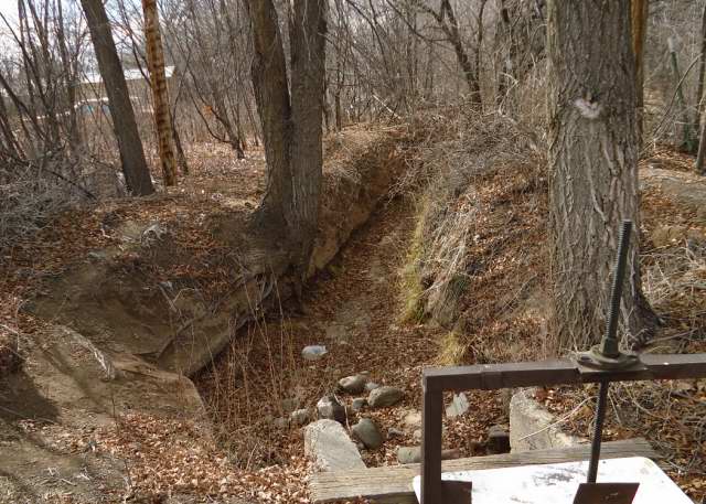
1. Vigil ditch near the public library next to the Chama Highway (84/285), 20 August 2011.

2. Vigil ditch preparing to go under the Chama Highway, 10 February 2012.

3. Gate controlling entry of the Vigil ditch into the Río Grande above the Griego Bridge, 10 February 2012.

4. Ditch paralleling Vigil ditch near former Block-Salazar funeral home, moving toward the Río Grande, 3 May 2009.

5. Vigil ditch enclosed in metal fence in front of Frank Bond house, 20 January 2012.

6. Vigil ditch in front of Frank Bond house, 20 January 2012.

7. Vigil ditch before it crosses under the Chama Highway, 3 May 2009.

Saturday, April 7, 2012

Shadow of the Reconquest - Culture Shocks

Fifteen years in refugee housing in Guadalupe del Norte must have had some effect on people who were wrenched from what at become a relatively cloistered world and thrown into the more cosmopolitan one nearer the silver mines of México.

After Diego de Vargas resettled New Mexico with recruits from Mexico City and Zacatecas, he and the subsequent Bourbon governors introduced more changes.

Fernando Durán y Chaves, the younger, and his wife, Lucía Hurtado de Salas y Trujillo, were the only members of Angélico Chávez’s family to return. The Franciscan historian says after the Reconquest, men in his family were no longer called into political or military matters as they had been. Such institutions had probably become more professionalized under the Bourbon bureaucrats or perhaps they just required men with different ambitions.

The family response seems to have been retreat. Fernando lapsed into senility. In 1712, he physically attacked the alcalde mayor of Albuquerque, Juan González Bas, as a “perro yndio Griego” and “un perro mulato.” González Bas was the descendant of Juan Griego who owned the Alameda grant north of his Atrisco grant.

In a similar incident in 1759, the ancien regime protested when José López Naranjo’s grandson, José António Naranjo, was made capitán de gente de guerra, They claimed he was only the commander of Indian troops, not the descendant of a conquistador like themselves. At that time, Chávez says, many of his supporters lived in Chimayó.

Chaves and his wife discouraged their children from mingling with newcomers, especially those from Zacatecas. The one who did, their great-grandson Cristóbal Chaves, had to visit his sister at Laguna to secretly marry a woman from Mexico City. The other descendants were reduced to asking the friars for dispensations to marry cousins because of the “paucity in this Kingdom of blood quality.”

One man they would have shunned was Francisco Montes Vigil, the original owner of the Alameda grant. It wasn’t that he was an español. Lucía’s family had had its share of misalliances, especially the marriage of her great-great-grandmother, María de Abendaño, to the bigamous Diego de Vera, a marriage that made her husband her cousin. There was also the more recent involvement of her sister Juana with some Naranjo.

The problem with Vigil was that he represented the new ways seeping north. Chaves was passing on the values of a disenfranchised nobility that had been resisting the power of a centralized government since Juan de Oñate was deposed, while the other was creating a culturally inherited ability to exploit institutional rules, adversity and even subjugation.

Vigil apparently connived with Juan Paéz Hurtado to pad the register of names recruited in Zacatecas and pocket commissions. Historians translating the papers of Vargas say his large family was broken into three units, each presumably paid the 320 peso recruiting fee, minus a kick back. When interrogated later, Vigil admitted he’d enlisted men from gambling halls under false names for Paéz and that Paéz kept 100 pesos for himself.

After he sold the Alameda grant to González Bas, Vigil and his family moved to the villa of Santa Cruz, perhaps because he saw more opportunities in the north, perhaps because it was a less hostile social environment for a restored mestizo raised by a well-connected father in an urban center.

His son, also Juan Montes Vigil, requested land north of the Truchas River in 1754. The land had become available when the alcalde, Juan José Lovato, changed the boundaries of the Truchas Land Grant made to eleven residents from Chimayó and Pueblo Quemado, five Romeros, four Espinosas, Francisco Bernal, and Cristóbal Martín. Vigil was an official witness to that transfer.

This wasn’t the only case of Lovato, the nephew or son of Bartolomé Labota who’d come with Paéz, changing grant boundaries. When Pedro Sánchez couldn’t produce the defining papers for his grant in 1742, Lovato altered the border with San Ildefonso. A Vigil descendant, José Ramón Vigil, bought eight of eleven shares in the grant in 1851 for $20, a yoke of oxen, 36 ewes and one ram.

Francisco, or one of his descendants ended up owning land between that of José López Naranjo and António de Salazar, perhaps after Naranjo died and Vigil survived the Pawnee attack in 1720 or maybe after Naranjo’s only son, José António Naranjo, fled the area in 1731 after killing someone.

No one has said exactly how it happened, only that the land was known as La Vega de los Vigiles when José Ramón’s daughter, Josefita Vigil, married José Benedicto Naranjo. Naranjo sold it to the Denver and Rio Grande, who, in turn, sold some to Frank Bond for his livestock shipping facility.

Benedicto was the great-grandson of José Geronimo Naranjo, the grandson of José López Naranjo. His son, José Alejandrino Naranjo, married Delfinia Vigil. Their son, Emilio Naranjo, was born in Guachupangue, the area abutting the Santa Clara reserve on the north.

Alejandrino had gone to the smelters and mines in Colorado to earn money rather than raise sheep for Bond. He sent his son to secondary school in Santa Fé and college in El Rito. Emilio built the Democratic Party in Rio Arriba county after World War II when Spanish speaking citizens in the area finally felt they were free to vote as they wished.

The railroad, of course, brought men like John Block who married Sofia Vigil Valdez. They adopted Fidel Salazar, the son of José Ramón Salazar and Francisquita de Sales Atencio, to raise as John Block, Junior. José Ramón was 20 years old when he became a father. Sofia was his aunt. Block senior was the prime mover behind building the Santa Cruz dam.

The only men of comparable ambition in the Chaves family were the children of Cristóbal Chaves and María Josefa Núñez. Some migrated to Ceboletta County when the Navajo were removed and others went to Mora County after Fort Union was established to control the Comanche.

Angélico was born to the latter branch. He remembered asking his mother, María Nicolasa Roybal, if any of her family were hermanos. She said “the family had always been such good Catholics that they had no cause for the joining the Penitentes.”

When he asked about the family of his father, Fabián Chávez, they had slipped so far she said “Your father’s people were not even good enough Christians to be Penitentes.”

Genealogies drawn from various sources:
Naranjo:
Alonso > ? > Domingo/? > José López > José Antonio > José Geronimo > António José > José Manuel > José Benedicto > José Alejandrino > Emilio

Vigil to Naranjo:
Francisco Montes > Francisco Montes > Manuel Gregorio > Nicolás António > José Ramón > Josefita who married José Benedicto Naranjo

Durán y Chaves/Chávez:
Pedro > Fernando > Fernando >António > Tomás > Cristóbal > José Mariano > José Encarnación > José Francisco > Eugenío > Fabián > Angélico

Salazar:
Hernán Martín Serrano > María Martín > María ? > Agustín Salazar > António Salazar > Francisco Miguel Salazar > María Salazar who married Julian Lorenzo Salazar > José Julian Salazar > Juan Francisco Estevan Salazar > Pedro Ignacio Salazar y Valdez > José Eutimio Salazar > José Ramón Salazar > Fidel Salazar/John Block Jr

Vigil to Salazar:
Francisco Montes > Juan Bautista Montes > António José Montes > Joe Dolores > María de la Luz who married Lorenzo Valdez > María del Carmel Valdez who married Juan Francisco Estevan Salazar

Notes:
Bowden J. J. “Ramon Vigil Grant,” New Mexico Office of the State Historian website.

Chávez, Angélico. Chávez: A Distinctive American Clan of New Mexico, 1989.

_____. My Penitente Land, 1974.

_____. Origins of New Mexico Families, revised 1992 edition.

Kessell, John L., Rick Hendricks, and Meredith D. Dodge. A Settling of Accounts: The Journals of Don Diego De Vargas, 1700-1704, volume 6, 2002.

Shiller, Mark. “The Truchas Grant,” available on-line.

Friday, April 6, 2012

Shadow of the Reconquest - José López Naranjo

José López Naranjo had an even greater need than Agustín de Salazar to prove his loyalty to the authorities if he wanted to remain in the area where he was born. His father, Domingo Naranjo, had been one of the leaders of the Pueblo Revolt of 1680 and he’d personally refused to spend the exile in Guadalupe del Norte.

In June of 1696, he established his bona fides when his brother Lucas was leading the Santa Clara resistance to the Spanish. José killed him and brought his head back to Diego de Vargas.

His ancestry is an even greater puzzle than Salazar’s. According to Angélico Chávez, Lucas had the dark complexion of the mulatto Domingo. José did not.

I suspect his ultimate Spanish ancestor was Alonso Naranjo, a native of Valladolid with a “tawny beard,” who came north with Bernabé de Las Casas in 1600, with 10 horses and 22 head of cattle. He left no further record, but the name Naranjo migrated into the pueblos, probably through children abandoned to their mothers.

According to Chávez, the mestizo heirs had contentious relations with their pure-blood cousins. Jémez killed Diego Martín Naranjo; San Felipe killed Bartolomé Naranjo in 1680 because they feared he’d betray their planned rebellion; a two-year old, María Naranjo, was kidnaped in 1680. Her mother, Juana Hurtado, also held captive, was the daughter of Andrés Hurtado, the father-in-law of Fernando Durán y Chaves.

Incidentally, that wasn’t the first connection between Chavez’s family and the Naranjos. Fernando’s father, Pedro Durán y Chaves paid Pascual Naranjo to take his place on a military campaign against other Indians. Pascual fled to Guadalupe del Paso with his family and didn’t return.

I suspect one of the women involved with Naranjo or one of their daughters was the one who became involved with a mulatto servant or teamster and gave birth to Domingo. Even today, a woman who has lost her status or sense of self worth may become vulnerable or open to other declassé men.

There’s no reason to think Domingo was involved with only one woman, especially after he acquired power in Santa Clara, nor, for that matter, is there any reason to believe a woman involved with him was monogamous. Lucas and José may have had different mothers or different fathers in one household.

Chávez thinks the name came directly through the father, some mulatto who came north with one of Oñate’s men and associated himself with Naranjo, taking his name. That man then worked as a herder in the area of Santa Clara, where he met the woman who would become Domingo’s mother. He believes the progenitor was part Tlascaltec and versed in Aztec lore.

Whatever the truth, José showed a willingness to destroy Indians on behalf of his Spanish masters. In 1702, he was alcalde mayor of Zuñi and active in subjugating the Hopi. In 1704, he was commanding native scouts in the campaign against the Apache, the one that caused Vargas’s death. In 1715, he was fighting the Navajo.

Unlike Salazar, he never asked for a land grant. Instead, he either settled on land between that claimed by Salazar and the Santa Clara on the west side of river, or received some from Salazar through a sale, trade, or gift.

Naranjo married María Catarina Luján, the illegitimate daughter of Matías Luján of Santa Cruz, who might have been the son of Juan Luján and brother of Juan Luis. The latter had the land north of that claimed by Salazar. Matías had married Francisca Romero, but had a daughter by a native servant. However, Chávez said, there was another Matías Luján in the area married to Catalina Verala, so nothing can be known absolutely.

Naranjo died in the Pawnee ambush of Pedro de Villasur in 1720, which Francisco Montes Vigil survived.

Notes:
Chávez, Angélico. Chávez: A Distinctive American Clan of New Mexico, 1989.

_____. Origins of New Mexico Families, revised 1992 edition.

Simmons, Marc. “Trail Dust: Part-Indian Was Loyal to Spanish Cause,” The New Mexican, 11 September 2009.

Wild Horses Southwest Art Gallery. “History of the Horse in the United States of America's West,” gallery website.

Thursday, April 5, 2012

Shadow of the Reconquest - Agustín de Salazar

Mestizos in Zacatecas like Francisco Montes Vigil had an easier time establishing their loyalty to Spain than those who’d lived in the colony before the Pueblo Revolt of 1680.

Agustín de Salazar was a blind interpreter for Diego de Vargas, who was described as “proficient in his mother tongue.” He demonstrated his loyalty in 1693 in Santa Fé when he warned his superiors about hostile actions planned by the Tano speakers. He was helped out of the city by Miguel Luján, the one who had land in La Cañada that Angélico Chávez thought was kin to Juan Ruiz Cáceres and Juan Luján, also of La Cañada.

His son, António de Salazar requested land in 1714 owned by his grandfather, Alonso Martín Barba, on the west side of the Río Grande near the villa of Santa Cruz.

As near as I can tell, these were lands settled by Hernán Martín Serrano, which means António had to prove his lineage to a man who was born in Zacatecas and came north with Juan de Oñate. He and his wife, Juana Rodríguez, had two sons, Hernán and Luis, who used the land on the west side of the river mentioned by Luis Pérez Granillo in his 1695 report on La Cañada.

Juana wasn’t identified by Chávez, so it’s not clear how or if she were related to Pedro Rodríguez and Juan Luján who came from the Canary Islands to La Cañada two years later. Rodríguez was a common enough name, but the overlapping names that characterized their families also marked her own descendants. However, the confluence of names is more likely the result of general inbreeding that developed over three generations in an isolated community.

In addition to the two boys, Juana and Hernán had a daughter, María Martín, who must have inherited land north of her brothers.

María Martín was poisoned by María Bernal, probably in 1632. The daughter of Juan Griego and Pascula Bernal was then the widow of Juan Gómez Barragán and romantically involved with María Martín’s husband, Alonso Martín Barba. Before María Martín died, she had a daughter, María, who later married Bartolomé de Salazar, the grandfather of Antonio.

That much was accepted by the governor who granted him the lands.

The life of the younger María was much of a mystery to Chávez. At one point he said she “was accused of scandalous conduct” by the Inquisition.

In one place Chávez said Martín Barba’s daughter, María de los Ángeles Martín, married Gaspar de Arratia, who was dead by 1631, when she was 22. Agustín de Salazar was 33 in 1698, which means he would have been born around 1665, when this woman would have been about 56 years old.

María Martín might not have been Martín Barba’s first wife; her brother Hernán was 25 in 1632. Alonso’s daughter, María de los Ángeles Martín, was 23 that year. He was married to Francisca de Herrera Abregna by 1634, when his daughter Ana Martín’s daughter, Ynez de Zamoa, married Juan López.

Chávez also said María de los Ángeles Martín, or a sister also named María, married Francisco de Salazar, or something close: the writing wasn’t legible.

Francisco de Salazar was executed in 1643 for his involvement in the murder of Luis de Rosas in 1641. Bartolomé de Salazar, the husband of María Martín and grandfather of Antonio, was dead before 1662. Neither Salazar is identified further by Chávez, probably because neither was inventoried as part of the troops with Juan de Oñate and Bernabé de Las Casas.

Elsewhere, Chávez said the María Martín who married Bartolomé de Salazar, may also have been married to Bartolomé de Ledesma, if the two weren’t the same man. Ledesma was dead by 1667 when her brother, Hernán Martín Serrano, was the executor of the second’s estate.

Bartolomé de Salazar was alcade for Zuñi and Hopi. He and María had a daughter, Juana de Salazar, who was half Zuñi. She married Diego Luján.

Although we usually assume it’s the man who fathers an illegitimate child with a native, in this case it may have been the mother. If Agustín de Salazar was 33 in 1698 and part-Indian, he would have been born around 1665, after Bartolomé de Salazar was dead, if we can accept any dates and ages from a time without records.

Agustín married Felipa de Gamboa, the daughter of Cristóbal de Gamboa and Antonia López, a Tiwa speaker from Sandía pueblo.

Their son, António, married María de Torres, the daughter of Cristóbal de Torres and Angela de Leyva, who moved from Albuquerque to Santa Cruz to Chama after the reconquest. Her brother, Diego, was alcalde mayor for Santa Clara.

Notes:
Chávez, Angélico. Origins of New Mexico Families, revised 1992 edition.

Granillo, Luis. Report for 12 March 1695, included Blood on the Boulders: The Journals of Don Diego De Vargas, New Mexico, 1694-97, volume 2, 1998, edited by John L. Kessell, Rick Hendricks, and Meredith D. Dodge.

Wednesday, April 4, 2012

Shadow of the Reconquest - Land Grants

Colonial life after the reconquest was different than before; Spanish Bourbons were more interested than the Spanish Hapsburgs had been in making physical claims to their empire against forays by French Bourbons and the English.

Conflicts with Apaches and other hostile groups were no longer seen as acts of the unconverted, but as extensions of European politics. People who weren’t allies could no longer tolerated. Tano speakers were forced from the Santa Cruz area, then out of Chimayó. Land was opened, and people needed to colonize it.

Earlier concerns with the loyalty of Jewish and Moorish converts to the emerging Spanish state transferred to mestizos. A new class was defined, the español, which Angélico Chávez says meant an individual who had been fully acculturated into Spanish life and was restored to trust of the community.

The first man to request land under the new regime was Angélico Chávez’s ancestor, Fernando Durán y Chaves, the younger, who requested 41,533 acres in 1692 north of modern Albuquerque, west of the Río Grande he claimed had been settled by his father before the Pueblo Revolt. However, Diego de Vargas wouldn’t let him move there until he’d completed the Reconquest.

As it was, Chávez says, Vargas had to battle Apache who’d stolen Chaves’ livestock in 1704. He became ill during that campaign and died. The Atrisco Grant wasn’t completely secure until the Tiwa speakers living in Alameda, Puaray and Sandía pueblos moved west to Hopi territory where they joined the Tano speakers who’d refused to resubmit to the Spanish.

In 1710, Francisco Montes Vigil requested more than 100, 000 acres of Tiwa land north of Chaves and west of the Río Grande in return for his services in the Reconquest. He claimed “he was retiring from the army and had acquired a small start of cattle” and so “needed the tract in order to maintain his family, which was large, and also as a pasturage for his animals.”

Vigil and his wife, María Jiménez de Ancizo, had come north in 1695 in the group from Zacatecas led by Juan Paéz Hurtado. Vigil’s grandparents, Juan Montes Vijil and Catalina de Herrera Cantillana, had sufficiently established their ancient hidalgo lineage to be able to migrate from Estremadura to Mexico City in 1611.

His father, Juan Montes Vigil was an unmarried Zacatecan merchant wealthy enough to own at least one mulatto slave woman. He entered some real estate transaction there with Cristóbal Zaldívar, no doubt, some sort of kinsman of Cristóbal de Oñate.

When Francisco and his wife were interviewed by Paéz, they were able to satisfy him they were españols. They arrived in Santa Fé with their five children and a free mulatto servant.

Rather than settle the land, Vigil sold the Alameda Grant in 1712 for 200 pesos to Juan González Bas, a man descended from Juan Griego through his daughter, Isabel Bernal, who had married Sebastián González. Two years later, when he was about 49, Francisco divided 40 head of cattle amongst his children.

He remained active in the military. In 1716 he was with Felix Martínez in his war with the Hopi and in 1720 went with Pedro de Villasur to investigate French influence among the Pawnee. He was one of the few who survived an ambush. He was dead in 1730 at about age 65.

Vigil wouldn’t have been the only one to disguise personal motives in the language expected by a government trying to populate the frontier. Chaves may have said he was reclaiming his father’s land, but in fact he was requesting adjacent land. In 1705 he sold his patrimony to his sister’s husband, Manuel Baca, who owned the land to south.

Notes:
Bowden, J. J. “Town of Alameda Grant,” New Mexico Office of the State Historian website.

Chávez, Angélico. Chávez: A Distinctive American Clan of New Mexico, 1989. Chávez believes the reason Chaves sold the land was his favorite son had been killed there in an accident.

_____. Origins of New Mexico Families, revised 1992 edition.

Hendricks, Rick, John B. Colligan, Charles Martínez y Vigil, José Antonio Esquibel, Stanley M. Hordes, Richard Salazar, and Robert D. Martínez. Research on Monte Vigil published on Genealogía de México Weblog.

Thursday, February 23, 2012

Santa Cruz Dam History - Part 2


It’s a fact of life in northern New Mexico, there’s only so much water. Once it was allocated, and it was allocated very early, the only way left to increase agricultural production was to improve the efficiency of the acequias. In 1925, 25% of the water was lost through seepage.

In the 1930's, the Department of the Interior found the Santa Cruz ditch was poorly constructed and required 25 days every summer to maintain. If the Llanos ditch had been straightened, it would have added a square mile to the irrigated land, but landowners who were spending 45 days a summer on maintenance weren’t interested. The Puebla ditch was the worst, built though porous soil, weakened by a nearby arroyo, and requiring 30 to 50 days each summer to repair.

If the ditches couldn’t be improved, John Block reasoned the delivery system could. In 1925, he organized the commercial growers of the Española area into a conservancy district and proposed a dam. With approval guaranteed through his friendship with Tom Burns, who controlled the Rio Arriba county board of commissioners, he got a favorable engineering report from the state.

Based on 8,000 irrigated acres and a 166' dam that would hold 18,000 acres of water, they calculated it would cost $30 an acre to build. The initial tax was $0.69 an acre. They got enough people to join the conservancy to issue bonds for $250,000. Only Chimayó refused in mass, which reduced the number of acres to 5,200.

As commodity prices stayed low in the 1920's, economic conditions deteriorated for both Frank Bond and the people indebted to him. The money for the ditch tax could only come from the cash they got selling their produce to local merchants, and many were too in debt to have any. Bond moved to Albuquerque to find better opportunities near the railroad there. Louis Nohl remained in charge of the local store. W. P. Cook was a trusted assistant.


The investment broker, Sutherlin Barry Bonding Company in Los Angeles, kept 5% of the bond money for themselves, and managed to sell the bonds through their New Orleans office. It was the 1920's and everyone believed the successes of California’s inland valleys could be replicated.

The contractor, Ajax Construction of El Paso, began work in 1926, spent the money in 18 months, built about half the dam and declared bankruptcy. Two other companies put some time into the project, and each of them went bankrupt. By 1928, the annual tax was $2.69 an acre and there were some delinquencies. After some wet years, the summer of 1928 had been hot and dry.

To finish the dam, the conservancy had to issue another $250,000 in debt, sold mostly to the same investors. The tax rate for 1929 went up to $8.36 an acre, just as the national economy was crashing. A severe winter in 1928 had killed half the sheep; floods damaged land in the fall of 1929. Delinquencies soared.


Anderson Brothers of El Paso began work. The bond holders sent a representative who reported $6.00 an acre was the most they could expect the land owners to pay. They began losing money of their investment.

When the dam was completed in 1931, it cost $6,000 more than the contract. It was only 131' high and had one third the projected capacity, 6,000 acres. It had cost $95 an acre to build.

The 1929 and 1930 seasons had been wetter than normal; excess water had damaged irrigation systems. The winters of 1931-1932 and 1932-1933 were severe enough to kill livestock while the summers were so wet flooding was a problem. $40 an acre was later calculated to have been the maximum land owners could afford.

The Conservancy couldn’t pay its debts and went into receivership in 1933. Before the Reconstruction Finance Corporation would intervene, all back taxes had to be paid. The federal bank told the bond holders they would $.25 on the dollar for their original investment, with no interest. An extended drought had begun in 1932.

At this point, Hugh Calkins’ history of the dam gets vague. Some unidentified entity called the Santa Cruz Real Estate and Land Company appeared with Mr. Cook as its agent. When he couldn’t collect the unpaid taxes, he had landowners sign agreements that he would pay their taxes for them, in exchange for rights to their land.

When all the taxes were paid, the RFC took over and sent in its financial people who reported the financial affairs were “pretty much of a mess.” The land company owned 397 acres of land taken from 92 individuals who often “were unaware that their lands had been sold from under them.”


The land company had resold 180 acres to men from Oklahoma and Texas, but it was “doubtful if the money from those sales ever reached the bondholders.”

Once the RFC was in charge, the annual tax was set at $1.00 an acre in 1935 and $2.90 in 1936. Delinquencies dropped. 1934 had been another drought year, but those who still had their land believed enough water had flowed to water the gardens that fed them.

Still, the drought continued and the economy worsened. The government was employing men on its project to clear the Río Grande malaria swamps, but only Leadville was hiring temporary help. A few men went into CCC camps. According to the Department of the Interior, 51% of the men around Española were or had been on relief.

The fortunes of the Bond company faltered. According to Richard Cook, the government price for sheep was half what Bond paid for them. Both Bond and Cook senior were so heavily in debt, they offered their lands to a bank that didn’t want any more unsellable assets. Bond died in 1936, and the family sold the assets and liquidated his holding company. Cook had recovered enough to buy the Española store.

Normal rains returned in 1937.


Notes:
Calkins, Hugh G. The Santa Cruz Irrigation District - New Mexico, 1937; best history of the dam.

Santa Fe New Mexican. “Provider or Destroyer,” 26 April 1998; includes quotation by Richard Cook.

Scurlock, Dan. From the Rio to the Sierra: An Environmental History of the Middle Rio Grande Basin, 1998.

US Department of Interior. Tewa Basin Study, volume 2, 1935, reprinted by Marta Weigle as Hispanic Villages of Northern New Mexico, 1975; best source for social and economic conditions in the Española valley in the 1930's.

Photographs: Local ditches, 2012; the top three are different segments of the first ditch to run in the spring, the one that feeds parts of the village; the fourth shows a lateral to the left, and the diversion to the property to the right; the bottom is a ditch in a farm field with the dam at the back.

Wednesday, February 22, 2012

Santa Cruz Dam History - Part 1


The Santa Cruz dam was a consequence of the Denver and Rio Grande railroad opening a station in 1881 in an area west of the Río Grande it called Española. It introduced men looking for economic opportunities into an area where local Spanish-speaking settlers saw land as their only source for food.

Surpluses moved between villages at different altitudes with different growing seasons. Truchas raised wheat, Santa Cruz grew fruit, Chimayó supplied chili, Colorado provided beans and potatoes. What cash existed came when men went to the mines in Colorado and Utah or worked as sheep herders in Colorado or Wyoming or section hands in Colorado and Arizona.

One man who followed the railroad from Pueblo, Colorado, was Frank Bond, a Canadian immigrant who had failed in the wool business there. In 1883, he bought land from the railroad for a stock shipping facility. He also opened a local store where people could pay for goods by raising sheep for him. Within a few years, most were indebted to him.

Another was Johann Block who arrived from Kansas around 1890. His father, Jacob Block, was a West Prussian who had migrated there with his family. John married Sofia Vigil Valdez and became a local landowner. His cousins, Heinrich and Jacob Jantz-johnson, also moved here; Henry was a bee-keeper, Jake a dairy man.


When war broke out in Europe in 1914, England could no longer import food from Russia and Germany. Prices rose in this country, even in the Santa Cruz valley. W. P. Cook came in 1915 and started work for Frank Bond as a stable boy.

Prices fell as soon as the war was over, and stayed depressed through the 1920's. Commercial farmers like to think the war years were the new normal and the present was an anomaly. One way to address it was produce more, and over-production throughout the decade kept commodity prices low nationally.

The new men weren’t deterred by the fact the easiest land to farm was taken. They believed all you had to do to make dry land productive was add water. In 1919, the commercial farmers petitioned the courts to revisit the distribution of water.


They didn’t understand demand for that water was already increasing. 1917 and 1918 had been dry years. The local population hadn’t been able to send its young to settle the frontiers after the United States took control of the land east of the Sangre de Cristo. Chimayó was taking more of the water before it could reach the valley. The court ruled in Chimayó’s favor.

Then, a man named Conger wanted to bring more land into production by building a 14 mile ditch from the Río Grande. The years between 1920 and 1925 were drought years in the state. When the ditch was completed in 1924, farmers turning chili into a commercial crop in the Mesilla Valley in the southern part of the state successfully protested the diversion of common water.


Notes:
Calkins, Hugh G. The Santa Cruz Irrigation District - New Mexico, 1937; best history of the dam.

Scurlock, Dan. From the Rio to the Sierra: An Environmental History of the Middle Rio Grande Basin, 1998.

US Department of Interior. Tewa Basin Study, volume 2, 1935, reprinted by Marta Weigle as Hispanic Villages of Northern New Mexico, 1975; best source for social and economic conditions in the Española valley in the 1930's.

Photographs: Santa Cruz Lake, 14 February 2012; boulders have been placed around the parking area.

Monday, February 13, 2012

River Rock


River rock is one of those terms used everywhere in the country that everyone knows what means and no one defines. Generally, it’s rock that has a relatively smooth surface. I say relatively, because its not as smooth as a polished tombstone, but it’s not jagged.

If you ask for something more specific, people take the adjective smooth and turn it into a verb. There the trouble begins, because they start to say things like “the erosive action of the moving water from a river smooths and shapes the stones. Other times, they say something slightly romantic like “smooth surfaces created by tumbling around in rivers for years.”

Maybe, elsewhere in the country. Here, even when the Rio Grande is running high, like it was in the above picture take last October under the Griego Bridge in Española, the water only creates rapids. You don’t see rocks being tossed about. More likely you see them laying outside the action where silt can filter through them.

Smoothing and polishing are not the same thing. The second is done by removing material, often by breaking large pieces into smaller ones. In a rock tumbler, the polishing is done by some kind of abrasive grit, something like silicon carbide, with water used as a facilitating lubricant, not as the active agent . The winds here move sand at high enough velocities to blast surfaces.


The above is a piece of granite I found in the area of the far arroyo this weekend. Part of it has striations that left a relatively smooth surface. The darker corner at the top in the picture below was untouched. There the smoothed section has a lighter color because the abrasion removed the tops of the softer, darker mica, but harder flecks of quarts remained.


The smoothing of river rocks is done by filling in rough surfaces with finer sand that drops when the river currents slow. It often is the same general material loosened by wind and deposited in the water. Eventually the sand becomes welded to the surface, like a rind.


I first noticed this with a bit of granite I picked up somewhere along route 554 north of Ojo Caliente last fall. You can see the brown outer skin is very different than the quartz and mica inner stone. If you look carefully, you can see the outer layer isn’t uniform in thickness, but penetrates in low edges to fill the rough places. That’s what creates the coarse textured, smooth feeling exterior surface.

If the river rocks were polished by removal, they’d look more like tombstones or the stone above. Instead, they look like amorphous potatoes. Round, formless, grey lumps.


Someone broke the above rock outside a near neighbor’s drive. Since he works for Cook’s Transit Mix, I assume the rock came from somewhere just north of Española. You can just see the lighter colored outer layer that built up around the granite, especially on the lower curve in the upper left had corner.


Last weekend my immediate neighbor had loads of sand brought into our shared drive by a friend of his who said it came from his yard in Velarde. A broken piece of granite filled with quartz and mica landed near my gate.


Again, you can see the boundary between pock marked grey shell and the uneven texture of the broken face. It may looked like it’s been smoothed by removal, but if you look closely you can see the uneven fill that protects the bright interior with a dull overcoat. In places it has even started to colonize the surface.

Saturday, February 11, 2012

The Ditch - The Left Bank

Now that I knew where to find the first legs of the local acequia, my next step was to trace the Santa Cruz river back to the diversion point. I began where the Santa Cruz enters the Rio Grande just north of the Griego Bridge in Española. Except at the water’s edge, where mechanical equipment can’t go, the land there’s been kept barren. It’s on the perimeter of a toxic dump site that’s actively being remediated.


The next place up stream I knew I could see the Santa Cruz was at the Riverside Drive (route 68) bridge. There the banks are more defined, perhaps because there’s no back flow from the confluence with the Rio Grande to erode them.


Immediately upstream, the river recovers its natural vegetation pattern, or at least the one that has come back and been left relatively undisturbed.


From there I drove into the first large commercial parking lot I found on the east side of the road. Behind the business, a large area had been scraped bare of any vegetation. Behind that wasteland, some cottonwoods had come back.


Beyond the trees, I found the river, apparently far enough away from any building that its course was left unmanaged. It had carved itself a winding path through sedimentary soils that varied by deposition, avoiding rocks where it could, eroding softer areas at will.


The depth was controlled by dams upstream, but the bottom was still littered with river rock.


I tried another parking lot, a bit farther upstream, where the grasslands before the cottonwoods were less disturbed. I could see houses through the trees that had to be on the other side of the river. However, a well-maintained chain link fence kept me confined to the parking lot.


There was one parking lot left to try before the highway started its climb out of town. The land owners there were definitely tired of people confusing their drive with a public road. There could be no explanations of innocence if I went down that road lined on the right by cottonwoods.


I’d seen as much as I was going to see of the left bank of the Santa Cruz.

Photographs:
1. Santa Cruz river just before it enters the Rio Grande, 29 December 2011.

2. Santa Cruz river just before it goes under highway 84/285, 20 January 2012.

3. Santa Cruz river upstream from 84/285, 20 January 2012; red sandbar willows marks the banks of the river.

4. Approach to Santa Cruz river from behind a business on 84/285, 20 January 2012.

5. Santa Cruz river behind a business on 84/285, 20 January 2012.

6. Santa Cruz river behind a business on 84/285, 20 January 2012.

7. Santa Cruz bosque behind a second business on 84/285, 20 January 2012.

8. Gate blocking access to the Santa Cruz behind a third business on 82/285, 20 January 2012.

Friday, February 10, 2012

The Ditch and the Highway


Design decisions by road engineers are not intuitive. You’d think they’d find the easiest route through terrain that changes level because it would be the cheapest, require fewer technical skills and less heavy equipment. Politics and population density, of course, always override those factors.

The route of 84/285 into Española is a puzzle. According to the area USGS map, the highway is just down from a 5750' gradation line on a great Tertiary mound that immediately rises another 25' on the one side and drops 25' on the other.

Why did they chose that path when it required moving so much dirt, then stabilizing the banks on both sides? In addition, they had to put that dirt somewhere. At least some of it was pushed on down the road toward the Santa Cruz river, because several of the surviving houses along the highway near the river crossing are way below the grade of the road.

There had to be some problem with that lowland alluded to by the use of checkered green squares on the map that made it more difficult to use than cutting through a great pile of unstable rock and sand.

I drove that stretch of road looking for some safe way to see the lower land. Most of the drives in that direction were private and looked steep enough to require a mountain goat to scale in bad weather.

When I did find one, I was totally surprised. About half way down the bank I saw the concrete banks of the local acequia.


Even more surprising, when I looked out over the lowlands I saw the rear addition of Iglesia de la Santa Cruz de la Cañada.


This section of road was just over a mile southwest of the village of Santa Cruz. The red line in the middle ground was the Santa Cruz river because those trailers are on the other side. Here was the river near my feet, not somewhere way north.

I started walking upstream along the ditch and discovered something else. Water from the highway was channeled into it. This means that, in an especially heavy storm, water from 84/285 is dumping into the near and far arroyos, digging those bottoms even deeper.


I stopped when I got to someone’s territorial marker, one that may have dropped accidentally, but deliberately hadn’t been cleared.


I looked beyond the tree. The ditch turned toward the river and began to go downhill. Down hill.


When I got home I looked more carefully at a map to see how I could have such a wrong idea about the course of the Santa Cruz river. The men who built the modern road from the Roman Catholic village of Santa Cruz to the Rio Grande made even more puzzling decisions than those made by the state engineers. Route 76 follows the river for a short time, then turns northwest to give the illusion the village is to the north.

It doesn’t meet 84/285 near the commercial area that developed around the Oñate bridge and the railroad, but comes out in what must have been comparatively empty land south of what was once a Mormon settlement at Fairview. Only a car would go there; not a man walking or driving an animal.


Photographs:
1. Road cut on 84/285 coming into Española, 27 January 2012.

2. Local acequia below 84/285, 3 February 2012.

3. Back of Iglesia de la Santa Cruz de la Cañada from the bank below 84/285, 3 February 2012. The line of red crossing the midground is sandbar willow growing along the Santa Cruz river. I drove over; those trailers are on the other side of the river. Santa Cruz badlands are in back.

4. Drainage for water from the highway dumping into the acequia, 3 February 2012.

5. Tree across the local acequia, 3 February 2012.

6. The local acequia turning in the direction of the Santa Cruz river, 3 February 2012; the fallen tree is in the center.

7. Intersection of Santa Cruz Road (route 76) with Riverside Drive (route 68).

Tuesday, November 1, 2011

Mastodons

The first time I heard of a mastodon I was sitting in a lecture hall at Michigan State listening to Russel B. Nye, who often combined cultural history with American literature.

I don’t remember what he said beyond a nearly complete skeleton found in Ohio had caused quite a sensation in the early nineteenth century. Somehow, I got the idea the skeleton was lying, fully exposed, on top of the ground and was stumbled upon much like the mounds had been.

I’ve since heard the animal was a glacier age mammal hunted by people using Clovis points. For some reason, that led me to think of them as great grass eaters.

When one’s interest in a subject is superficial, one’s knowledge tends to become a brew of facts, romantic legends and false conjectures.

I was, understandably, quite startled to find someone I think was Francis Klett say:

“In these beds, near Ildefonso, I made some excavations in 1873, while on the way to Fort Defiance under your expedition, (division 2,) and brought to light fossil bones of a mastodon, only one of them perfect, however; others were broken and yielded but fragments.”

The quotation is from the 1873 Annual Report of George’s Wheeler’s Geographical Surveys West of the 100th Meridian, and the location must be somewhere just north of route 502. That’s almost as close as the Otowi Bridge.

I suddenly needed to know more about mastodons. As I read, accretions of secretly hoarded facts dissolved.

It was true mastodons were glacial creatures and had been found in association with Clovis points.

However, they were associated with cold spruce woodlands, not grassland refuges.

Spruce growing where grass has been having a hard time surviving this year's drought.

Spruce near the Otowi bridge when those boulders blocked the Rio Grande creating lakes.

Spruce along those arroyos with the Qayi late-glacial sediments identified by Daniel Koning.

Spruce in my backyard. Who cares about a mastodon eating the foliage. Cold climate spruce right here where I’m writing.

Spruce.

Monday, October 31, 2011

Lakes


The morning of the day the Las Conchas fire started, the air was so hot, the soil so dry I went looking to see if any prickly pear were blooming anywhere this season.

One place I walked was an open field just beyond the near arroyo. Nothing. Not a flower, hardly a healthy plant in a place they bloom year after year.

The Pacheco fire was still burning towards Tesuque and was sometimes visible from the road in the area. I looked that way from somewhere in the center of the field and, besides smoke, saw something I’d never noticed before. The field looked like a great bay that water had washed over from a break in the badlands.

Saturday, when I was in the near arroyo, I wondered how it connected to that open space which it had to border somehow. The bed narrows between five or six foot walls a little beyond the point where water begins channeling itself for the culverts. As I went up stream from there, it turned to the left and suddenly opened into a great, wide expanse with almost no banks.


I remembered something similar in the far arroyo. Yesterday I walked back to refresh my memory. Again, the tall walls make a turn, this time to the right, and a great expanse opens.


I came home to pour over Daniel Koning’s map of the Española quadrangle and I noticed something I’d missed before, that some of the places I’d read as Qay1 were really Qayi.

Qay1 is his code for alliuvial soils laid down in the first phase of the post-glacier Holocene period. The river bottom is Qay2, a younger layer.

Qayi turns out to be some intermediate phase of sand and gravel bands, the very strata I’d noticed along some of the taller walls in the far arroyo. The same pattern appeared in the shallow walls of the great expanses of both arroyos. This is precisely where he’d marked Qayi on the map.


Some passing reference in Ted Galusha and John Blick’s article on Española sedimentation that I’ve slowly been reading sent me to look up the Otowi lava flows they said had dammed the Rio Grande in recent times.

I discovered Steven Reneau and David Dethier’s work on area lakes created when landslides dammed the Rio Grande around the Otowi bridge. One occurred around 43 thousand years ago and created a lake some 15.5 miles long that lasted anywhere from a hundred to a thousand years.

Another landslide created a pool 13 miles long about 17.5 thousand years ago which broke suddenly. The most recent, formed about 12.4 thousand years ago, was also about 15.5 miles long and filled completely with layers of sediment.

During much of this time, the very end of the Pleistocene, there was greater rainfall than now, so the river levels would have been higher. The most recent lake was 100' deep.

This area is well within 10 miles of the Otowi bridge, probably much closer if you’re a crow or a drop of water.

One small mystery has been solved, the origin of those gravel bands. What still is unknown is why the channels that are being opened now in the arroyos and washes were there to be filled by Qay1 and Qayi in the first place.

Sunday, October 30, 2011

The Cone


This afternoon I went back to the cone, determined not to be fooled again by its wiles. This time I took the simple path, the one from the near wash. As I walked up the easy grade, I realized the cone might just be the tip of the hill I live on, the one that had caused so many water problems in the past.

As soon as I got close I saw that it wasn’t bare because of erosion caused by the ATV rider. It was actually stone and not some soft soil. Daniel Koning had said it was tertiary, not the more recent quaternary. The two were there to see on the slope where the grass couldn’t hold its own.


I started climbing the cone. The more I climbed, the more the top receded into a face of gravel.


I felt no overwhelming urge to make it to the top and yodel. My knees were chanting "Jack and Jill went up the hill." The view of the black mesa was quite spectacular where I stood.


On the way back down I picked up some pieces of the grey, rough textured stone for the Rock Queen.


Hopefully she can tell me what it really is, something more useful than tertiary side of the geological change.

Soot


This morning I walked to the far arroyo for the first time since Wednesday’s rain. Everywhere there were signs of the Las Conchas fire.

When I entered below the ranch road I saw black soot laying in water paths left on the bottom.

As I walked up stream I saw the charcoal trails along the low left banks. As I came back down, they were also on the right side, swirling along the base of the high walls.

I could only think it’s a Goldilocks situation. Earlier this summer, when water scoured the bottom of the arroyo, it was passing through so quickly it left little behind. Other times, the rain was so gentle it only moved silt a few feet. The traces of black were slight.

Wednesday it rain most of the day and much of the night, a gentle rain that soaked in. I’m guessing that it washed a layer of sand from the surface of those blocks I noticed earlier where it had accumulated and the soot and sand landed somewhere down stream.


Upstream, there must have been other patches of ash waiting to move. Each time this year when some dark dust moved from higher up the arroyo, it replaced some that had been washed down stream. Perhaps it had slowly become concentrated in areas near the main water paths. Finally, there was enough rain to collect it and move it slowly where it could drop between Wednesday’s showers.

The fire was suddenly visible everywhere again.