Showing posts with label Arroyo Seco. Show all posts

Tuesday, April 3, 2012

Arroyo Seco - Human Factors


There are human factors affecting Arroyo Seco, but they are less dramatic than elsewhere.

A friend told me that before the bridge was built, the arroyo ran so hard it flipped a car and killed a friend.

Since they built the bridge, they’ve done things to protect the bridge and downstream residential property, including installing rock and wire reinforcements before the bridge. Below the bridge, they built levees on both sides to contain the flow.


Judging from the levees, the water must flow stronger to the right bank after the bridge. The area beyond is a wide wash.


Downstream the water may shift to the left.


The levee of that side become higher and wider, with more vegetation of both sides, presumably from more absorbed water.


Just before the arroyo crosses into the more recent alluvial soils, the water has carved an island.


The arroyo curves to the right, but there’s a spillway toward the left bank.


After the waters rejoin, the right bank is higher, straighter and more exposed than the left.


That flow continues to the confluence with the Río Grande, where the left side of the bottom is lower than the right and water flows back into the arroyo.

Monday, April 2, 2012

Arroyo Seco - Natural Influences


After I read Luis Granillo’s description of La Cañada with houses destroyed by an arroyo, I thought it time to see the rest of Arroyo Seco. I’d seen upstream parts that were accessible by car, but never ventured downstream from the bridge I cross to get into town.

The thing that has always struck me about this arroyo is that beyond the bridge it becomes the prettiest of the arroyos in the area, a wide sandy road winding between tree lined banks. Compared with the others, there is no deep erosion.

That may, in part, be due to human factors. This arroyo goes through residential, rather than pueblo land. The land owners are present, and probably much more likely to report people on ATVs breaking through fences and tearing by their houses. When I was walking in the arroyo, someone’s security system started screeching.

While early settlers must have grazed their cattle in the area upland from their irrigated fields, there may not have been the density of livestock there was in my area where ranchers were active and so less trampling disturbed the surface.

Perhaps more important, there are no major irrigation ditches dumping into the arroyo. Instead, waters are directed toward the Río Grande. The only one I know is the runoff from a lateral that drains from the acequia that comes to my area. The ditch is now buried and comes under the road, then the pipe just stops, leaving the water to find its way to the arroyo.

A large cottonwood has grown and directed its path.


The natural ditch is narrow and deep, but has little impact on the arroyo. The most it has done is expose some of the underlying rocks and pebbles.


When I looked at Daniel Koning’s geological map of the area, I realized there were also some historic reasons for the differences in this arroyo. Most of the settled land in the area is alluvium from the middle to upper Holocene that “generally supports junipers and grass” but with limited soil development.


Near the river most areas are more recent deposits that “supports sparser plant growth, particularly in regards to grass and trees, but more abundant woody shrubs.”


This arroyo is different in two ways. The confluence with the Río Grande is more subject to annual deposits, so, Koning says, the surface is “not vegetated and there is no soil development.”


The upstream banks are an upper Holocene deposit that Koning thinks “is probably related to regional arroyo incision and stream complex response phenomena that episodically occurred over the last several hundred years (since 800 to 2,000 years ago in the Rio Tesuque drainage).”

One forgets this arroyo has its origins in the Tertiary badland watershed with the Pojoaque River, while the arroyos near my house arises in closer Tertiary sedimentary ridges. Whatever those differences in rocks, which Koning defines in detail, the effect is the banks do not erode as easily.

Thursday, February 9, 2012

The Ditch - Port of Entry


A highway created my view of the local landscape, a road that’s not even the original one that connected the colonial capital of Santa Fé with the Spanish settlement of Santa Cruz and the northern pueblos. According to the 1940 WPA Guide to 1930's New Mexico that road originally went through Santa Cruz, but was moved west “a few years ago.”

It was moved to speed tourists between Santa Fé and Taos who were impatient with the twists and turns of roads built for ox carts. When gas stations and stores and homes sprouted along the new road, 84/285 became a bottleneck made worse by drivers more intent on turning into badly graded parking lots than maintaining the flow of traffic. The need to watch them makes it difficult to notice the twists in the road.

My image of the road from Pojoaque, described in a posting for 3 November 2011 on the “Santa Fe Group,” was that it went through Tertiary sediments laid down, after the Velarde half graben dropped, but before the Rio Grande existed, from debris washed down from the Peñasco Embayment north of the Picuris river. Animal fossils date to the Miocene Barstovian period of 14 to 15 million years ago.


To understand how Arroyo Seco could possibly cross my local ditch, I had to imagine what the land was like before those sediments were disrupted and rearranged by faulting events. I tried to think of the area as a rolling plain with the Santa Cruz river, Arroyo Seco and Pojoaque Creek flowing down from the Sangre de Cristo. The bones of extinct large mammals have been found in the badlands near those ancient rivers.

This week, I drove down to the Nambé exit north of Pojoaque and came back trying hard to see through the dramatic present to the past when the arroyo first carved its bed.

Route 84/285 rises some 125' as it leaves the -5825' valley of Pojoaque Creek to peak somewhere around -6000' west of a 6073' peak called Nambé on the USGS map. In a quarter mile, the road angles left and begins its descent into the valley of Arroyo Seco. It’s crossed the watershed between the two waterways.


For a short distance it levels around -5925' with a wide open space to the right. This is where those feeder arroyos are flowing somewhere out of sight in the hills.


Within a mile, the road is forced east by the intrusion of a -6000' pile of sediment, something you would expect if you were following a river through the herringbone pattern of alternating east and west ridges. This is just before the tributary arroyos reach the main one.


From there the highway goes left again, and drops to the valley floor at roughly 5725'. The tributaries have now joined Arroyo Seco and it becomes visible from the road. It’s banks are low. The alluvial soils must be so soft, what water flows through there simply spreads.


From there it flows west as described in the previous post.

Note: Elevations are estimates based on the USGS map. It’s quite possible I’ve misread the gradation lines in places. These maps are not my area of expertise.

Photographs:
1. McCurdy Road near Iglesia de la Santa Cruz de la Cañada,7 February 2012. There are no shoulders and no passing room between walls that block the view of curves.

2. Los Barrancos on the west side of 84/285, north of Pojoaque on Pojoaque pueblo land, 2 November 2011.

3. East-west ridge you cross on 84/285 as you enter the Arroyo Seco valley from Pojoaque, 2 November 2011; view to the east.

4. Arroyo Seco valley to the east from route 84/285, 2 November 2011.

5. 284/285 getting ready to swerve around the formation on the west, 2 November 2011.

6. Arroyo Seco from Bar D Four Road looking south, 6 February 2011; 84/285 is the grey line behind the trees.

Wednesday, February 8, 2012

The Ditch - Arroyo Seco


When I found that main part of the local acequia, I followed the banks a little upstream only to discover it turned toward the badlands that exist by my house.

I looked in the other direction and saw a huge mound of dirt, some 80' high, behind an arroyo bridge.


My mental map was shattered. The ditch was heading south when I believed its source was to the north. I’d gotten that idea from driving though Española.

After you cross the bridge on 84/285 where the Santa Cruz river turns to enter the Rio Grande, you drive three-quarters of a mile along the Rio Grande to reach route 76 that goes to the village of Santa Cruz. From there, it’s more than a mile to McCurdy Road and the church. You don’t actually see the river until you’re on your way to Chimayó.

I always assumed the Santa Cruz river got to the bridge the same way I did.

Suddenly I realized, if the ditch did come from the north, it had to get around that mound and cross an arroyo where there’s no sign of a flume. With everything I believed in disarray, I repeated a mantra from the laws of physics.

Water does not flow uphill.
Water does not fly.
Water does not flow uphill.
Water does not fly.

I couldn’t believe that arroyo near the ditch was the source of the acequia. It’s just too insignificant. It almost never has any water in it, even after a hard rain. The banks are low, the bottom wide. There’s no way it could be feeding the water that carved the high banks of the far arroyo, unless there’s some dam hidden somewhere.


Maps show the red bridge crosses the Arroyo Seco. I never connected the arroyo I cross daily with the Arroyo Seco near the highway to Pojoaque and Santa Fé. Dry Ditch is an even more common name than Black Mesa.

I just assumed the one on 84/285 meandered off west somewhere toward the Rio Grande after it passed under the road at the La Puebla exit. After all, it’s impossible to see north of Boneyard Road, the next road going west. Even when the camera’s zoom lens is pushed beyond its limits, the arroyo is nearly invisible.


Between Boneyard Road and the approach to Española, small, commercial buildings block the view to the west. In that stretch, there can be no arroyo because there is no landscape.

The other arroyo, the one on the side road, has always simply existed as some primordial presence. If I ever thought anything, it was that it formed from drainage from the immediate badlands.


I realized when you’re driving to some destination, the passing landscape is merely a backdrop that’s changed between the different scenes of your life. There’s no continuity in stage setting because there’s no mental connection between where you pass during the week on your way to work and where you go shopping on weekends.

But, of course, continuity exists outside one’s experience, and there is only one Arroyo Seco in this area. The USGS map for the Española quadrangle shows it forms from three intermittent creeks that flow north through those hills to the east of 84/285 north of Pojoaque. Each of those has two branches. There’s also one short tributary coming from the north.

They merge with another arroyo coming from the east into a northwest tracking sand bed.


Soon after, the arroyo goes under the road before the La Puebla exit, parallels 84/285 for a short distance then continues to flow between the badlands and the mound before if somehow intersects the ditch.


It is the same arroyo. There is no secret dam holding back water for the acequia. Its two appearances, on two different roads, create the illusion of bifurcation.

Photographs:
1. Local acequia heading back toward the distinctive badlands formation, 20 January 2012.

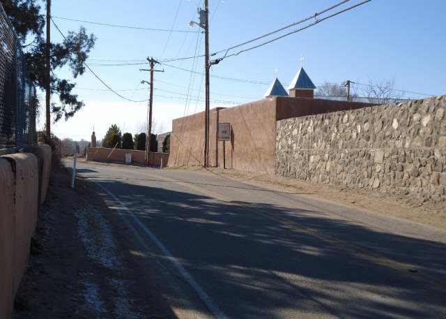
2. High mound of Tertiary sediment behind the red side road bridge that crosses Arroyo Seco, 7 February 2012.

3. Arroyo Seco on the other side of the red bridge, 6 February 2012; there is no flume visible.

4. Arroyo Seco disappears before the boundary between private land on Boneyard Road and Santa Clara pueblo land, 7 February 2012. It’s probably that band of sand on the left below the buildings. Color is distorted by the camera’s overextended zoom lens.

5. Arroyo Seco reappears as the sandy streak below the badlands looking west from the 84/285 access road, 7 February 2012. The feeder was probably created by drainage from the highway.

6. Arroyo Seco before the white La Puebla exit bridge, 6 February 2012; highway is on the left.

7. Arroyo Seco downstream from the distinctive badlands formation and before the bridge shown above, 6 February 2012; there is no flume visible.