Sunday, January 1, 2012
A Watershed
Sometimes a watershed is more than a parting of the waters.
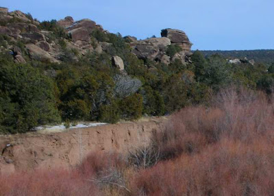
This week I drove southeast from Santa Fe toward Clines Corners on route 285. After passing the rump end of the Sangre de Cristo, the road passes through the Galisteo basin where grasses spread from both sides of the road.
Then, volcanic debris reappears with juniper trees. I stopped somewhere near mile marker 268 where an open expanse of four-winged saltbush outlined what must have once been flood land.
Snow from last week’s storm still veneered the land, but didn’t cover the taller plants. A few black cattle were visible in the distance. It was considered range land.
Just a few miles down the road glazed snow spread to the horizon. Shrubs were half-buried. The wind picked up. Just beyond Clines Corners plows were out keeping the right lane to Vaughn cleared from blowing snow.
When I drove back I noticed a sign somewhere between the two points where I’d stopped to take pictures that indicated I had crossed into the Galisteo watershed.
Apparently, this didn’t just mark the boundary between the volcanic Rio Grande valley and the great plains. It denoted a change in climate as well.
Pictures taken 29 December 2011 on route 285. Top taken about mile marker 277. Second around mile marker 268. The others near mile marker 263, less than five miles away.
Subscribe to:
Post Comments (Atom)


No comments:
Post a Comment