Thursday, February 23, 2012

Santa Cruz Dam History - Part 2


It’s a fact of life in northern New Mexico, there’s only so much water. Once it was allocated, and it was allocated very early, the only way left to increase agricultural production was to improve the efficiency of the acequias. In 1925, 25% of the water was lost through seepage.

In the 1930's, the Department of the Interior found the Santa Cruz ditch was poorly constructed and required 25 days every summer to maintain. If the Llanos ditch had been straightened, it would have added a square mile to the irrigated land, but landowners who were spending 45 days a summer on maintenance weren’t interested. The Puebla ditch was the worst, built though porous soil, weakened by a nearby arroyo, and requiring 30 to 50 days each summer to repair.

If the ditches couldn’t be improved, John Block reasoned the delivery system could. In 1925, he organized the commercial growers of the Española area into a conservancy district and proposed a dam. With approval guaranteed through his friendship with Tom Burns, who controlled the Rio Arriba county board of commissioners, he got a favorable engineering report from the state.

Based on 8,000 irrigated acres and a 166' dam that would hold 18,000 acres of water, they calculated it would cost $30 an acre to build. The initial tax was $0.69 an acre. They got enough people to join the conservancy to issue bonds for $250,000. Only Chimayó refused in mass, which reduced the number of acres to 5,200.

As commodity prices stayed low in the 1920's, economic conditions deteriorated for both Frank Bond and the people indebted to him. The money for the ditch tax could only come from the cash they got selling their produce to local merchants, and many were too in debt to have any. Bond moved to Albuquerque to find better opportunities near the railroad there. Louis Nohl remained in charge of the local store. W. P. Cook was a trusted assistant.

The investment broker, Sutherlin Barry Bonding Company in Los Angeles, kept 5% of the bond money for themselves, and managed to sell the bonds through their New Orleans office. It was the 1920's and everyone believed the successes of California’s inland valleys could be replicated.

The contractor, Ajax Construction of El Paso, began work in 1926, spent the money in 18 months, built about half the dam and declared bankruptcy. Two other companies put some time into the project, and each of them went bankrupt. By 1928, the annual tax was $2.69 an acre and there were some delinquencies. After some wet years, the summer of 1928 had been hot and dry.

To finish the dam, the conservancy had to issue another $250,000 in debt, sold mostly to the same investors. The tax rate for 1929 went up to $8.36 an acre, just as the national economy was crashing. A severe winter in 1928 had killed half the sheep; floods damaged land in the fall of 1929. Delinquencies soared.


Anderson Brothers of El Paso began work. The bond holders sent a representative who reported $6.00 an acre was the most they could expect the land owners to pay. They began losing money of their investment.

When the dam was completed in 1931, it cost $6,000 more than the contract. It was only 131' high and had one third the projected capacity, 6,000 acres. It had cost $95 an acre to build.

The 1929 and 1930 seasons had been wetter than normal; excess water had damaged irrigation systems. The winters of 1931-1932 and 1932-1933 were severe enough to kill livestock while the summers were so wet flooding was a problem. $40 an acre was later calculated to have been the maximum land owners could afford.

The Conservancy couldn’t pay its debts and went into receivership in 1933. Before the Reconstruction Finance Corporation would intervene, all back taxes had to be paid. The federal bank told the bond holders they would $.25 on the dollar for their original investment, with no interest. An extended drought had begun in 1932.

At this point, Hugh Calkins’ history of the dam gets vague. Some unidentified entity called the Santa Cruz Real Estate and Land Company appeared with Mr. Cook as its agent. When he couldn’t collect the unpaid taxes, he had landowners sign agreements that he would pay their taxes for them, in exchange for rights to their land.

When all the taxes were paid, the RFC took over and sent in its financial people who reported the financial affairs were “pretty much of a mess.” The land company owned 397 acres of land taken from 92 individuals who often “were unaware that their lands had been sold from under them.”


The land company had resold 180 acres to men from Oklahoma and Texas, but it was “doubtful if the money from those sales ever reached the bondholders.”

Once the RFC was in charge, the annual tax was set at $1.00 an acre in 1935 and $2.90 in 1936. Delinquencies dropped. 1934 had been another drought year, but those who still had their land believed enough water had flowed to water the gardens that fed them.

Still, the drought continued and the economy worsened. The government was employing men on its project to clear the Río Grande malaria swamps, but only Leadville was hiring temporary help. A few men went into CCC camps. According to the Department of the Interior, 51% of the men around Española were or had been on relief.

The fortunes of the Bond company faltered. According to Richard Cook, the government price for sheep was half what Bond paid for them. Both Bond and Cook senior were so heavily in debt, they offered their lands to a bank that didn’t want any more unsellable assets. Bond died in 1936, and the family sold the assets and liquidated his holding company. Cook had recovered enough to buy the Española store.

Normal rains returned in 1937.


Notes:
Calkins, Hugh G. The Santa Cruz Irrigation District - New Mexico, 1937; best history of the dam.

Santa Fe New Mexican. “Provider or Destroyer,” 26 April 1998; includes quotation by Richard Cook.

Scurlock, Dan. From the Rio to the Sierra: An Environmental History of the Middle Rio Grande Basin, 1998.

US Department of Interior. Tewa Basin Study, volume 2, 1935, reprinted by Marta Weigle as Hispanic Villages of Northern New Mexico, 1975; best source for social and economic conditions in the Española valley in the 1930's.

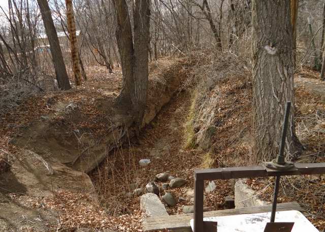
Photographs: Local ditches, 2012; the top three are different segments of the first ditch to run in the spring, the one that feeds parts of the village; the fourth shows a lateral to the left, and the diversion to the property to the right; the bottom is a ditch in a farm field with the dam at the back.

Wednesday, February 22, 2012

Santa Cruz Dam History - Part 1


The Santa Cruz dam was a consequence of the Denver and Rio Grande railroad opening a station in 1881 in an area west of the Río Grande it called Española. It introduced men looking for economic opportunities into an area where local Spanish-speaking settlers saw land as their only source for food.

Surpluses moved between villages at different altitudes with different growing seasons. Truchas raised wheat, Santa Cruz grew fruit, Chimayó supplied chili, Colorado provided beans and potatoes. What cash existed came when men went to the mines in Colorado and Utah or worked as sheep herders in Colorado or Wyoming or section hands in Colorado and Arizona.

One man who followed the railroad from Pueblo, Colorado, was Frank Bond, a Canadian immigrant who had failed in the wool business there. In 1883, he bought land from the railroad for a stock shipping facility. He also opened a local store where people could pay for goods by raising sheep for him. Within a few years, most were indebted to him.

Another was Johann Block who arrived from Kansas around 1890. His father, Jacob Block, was a West Prussian who had migrated there with his family. John married Sofia Vigil Valdez and became a local landowner. His cousins, Heinrich and Jacob Jantz-johnson, also moved here; Henry was a bee-keeper, Jake a dairy man.


When war broke out in Europe in 1914, England could no longer import food from Russia and Germany. Prices rose in this country, even in the Santa Cruz valley. W. P. Cook came in 1915 and started work for Frank Bond as a stable boy.

Prices fell as soon as the war was over, and stayed depressed through the 1920's. Commercial farmers like to think the war years were the new normal and the present was an anomaly. One way to address it was produce more, and over-production throughout the decade kept commodity prices low nationally.

The new men weren’t deterred by the fact the easiest land to farm was taken. They believed all you had to do to make dry land productive was add water. In 1919, the commercial farmers petitioned the courts to revisit the distribution of water.


They didn’t understand demand for that water was already increasing. 1917 and 1918 had been dry years. The local population hadn’t been able to send its young to settle the frontiers after the United States took control of the land east of the Sangre de Cristo. Chimayó was taking more of the water before it could reach the valley. The court ruled in Chimayó’s favor.

Then, a man named Conger wanted to bring more land into production by building a 14 mile ditch from the Río Grande. The years between 1920 and 1925 were drought years in the state. When the ditch was completed in 1924, farmers turning chili into a commercial crop in the Mesilla Valley in the southern part of the state successfully protested the diversion of common water.


Notes:
Calkins, Hugh G. The Santa Cruz Irrigation District - New Mexico, 1937; best history of the dam.

Scurlock, Dan. From the Rio to the Sierra: An Environmental History of the Middle Rio Grande Basin, 1998.

US Department of Interior. Tewa Basin Study, volume 2, 1935, reprinted by Marta Weigle as Hispanic Villages of Northern New Mexico, 1975; best source for social and economic conditions in the Española valley in the 1930's.

Photographs: Santa Cruz Lake, 14 February 2012; boulders have been placed around the parking area.

Tuesday, February 21, 2012

The Ditch - Headwaters


In the year of the American Revolution, before there were dams or modern roads to confuse one’s sense of geography, Fray Francisco Atanasio Domínguez visited the church at Santa Cruz as part of a general review of their missions by the Franciscans.

He noted the village was near a “river, which, although it arises in the aforesaid sierra from three not very large springs, is joined from very high up by three or four rivulets which feed it more water than it brings from it source, and therefore it is permanent.”

The sources are today called the Río Frijoles and Río Medio which join before the river enters Santa Cruz Lake, and the Río Quemado which joins soon after it escapes impoundment.

The Picuris-Pecos fault that Patrick Sutherland says occurred during the Laramide Orogeny when the Sangre de Cristo were being formed the last time defines their origins to the east. On its west side, the fault thrust Precambrian rocks of the Ortega Formation over existing Pennsylvanian strata to the east. Embudo granite exists to the west.

The Jicarilla Fault, which dips in the opposite direction, lies a few miles to the east. It also appeared in Laramide times and now separates the Pennsylvanian from the Precambrian quartzite of the Truchas Range.

The Frijoles arises before the Picuris-Pecos Fault and curls south and west through the widening Panchuela West.

The origins of Río Medio lie farther north and east in the watershed before the Río Grande and Pecos known as Trailrider’s Wall that runs from Truchas Peak to Pecos Baldy. From there it crosses both the Jicarilla and Picuris-Pecos faults.

Río Quemado begins east of the Picrus-Pecos fault, with the south fork coming from somewhere between Middle Truchas Peak and Truchas Peak. The north fork leaves a glacial cirque near North Truchas Peak and falls 100' at the Quemado Falls.

All the mountain rivers are accessible to hikers and fishermen who aren’t intimidated by Forest Service warnings that a trail is not only difficult but hard to locate.

For common folk, the last you see of the Frijoles is in a valley that lies some 75' below route 503. Settlers in Cundiyo have dug ditches from the curving river to water what look like flattened hay fields.


The Medio is less visible as it wanders along the edge of a privately owned meadow just north of the confluence with the Frijoles. Even fisherman can’t get through there.


Río Quemado is hidden by the settlement of Cordova and by scrub that’s grown along its banks, but, away from the road, flows there through a fairly broad valley.


This is as far north as I can follow the Santa Cruz, and it’s as far north as settlement had penetrated when Domínguez counted 125 families living in the village of Santa Cruz, 71 in Chimayó after the confluence, 52 in Quemado and 26 in Truchas just beyond.

Notes: Francisco Atansio Domínguez. Republished 1956 as The Missions of New Mexico, 1776, translated and edited by Eleanor B. Adams and Angélico Chávez.

Photographs:
1. Río Frijoles as it joins the Rio Medio, 14 February 2012.

2. Río Frijoles below 503 east of Cundiyo, 16 February 2012; the river is marked by the red willow; the differences between the near hills and the Sangre de Cristo may be marked by the differences in vegetation in back.

3. Río Medio just before its merger with the Río Frijoles along route 503, 14 February 2012.

4. Río Quemado at Cordova just off county road 83, 21 February 2012.

Monday, February 20, 2012

The Ditch - The Dam


The Santa Cruz dam sits near the edge of an uplift of Mesoproterozoic granite topped by early Pleistocene sandy gravel.

Daniel Koning’s geological map for the Cundiyo quadrangle shows the uplift lies between two north-south faults with the western one through the reservoir and the eastern roughly along route 503. Both are moving east. Between them, northeast of the lake, is another, shorter fault that curves and is moving northeast.

The sedimentary land at the top of the dam basin is 6300'. The structural and hydraulic heights of the dam are 151' but only 100' is available to hold water. The width of the dam at its base is 103.6'. That means the crack in the uplifted rock, at its narrowest, is something like 150' x 100'.


The lake covers 121 acres at the top and looks to be roughly 4000' long from the face to the point where the bowls narrows and water is white in the picture below. The opening widens to 600' in places.


From there the Santa Cruz river runs for a mile to the point it forms at route 503. It first goes south where the land above is 6400', then curves to go northeast where the surface land is 6600'. It flows through what Craig Martin describes as a “narrow, rocky canyon.”


The 10' to 15' wide river has “shallow runs and many holes 4 to 10 feet deep” for brown trout. That means, the the crack goes more than 10' below the surface and the river bottom is rock fill.


Martin say’s it’s possible to walk the river, nearly to the dam, if you’re willing to wade through the water and navigate those openings.

You don’t need to venture so far to see the rocks that form the walls of the reservoir. They’re visible on route 503 where the river begins it narrow journey. Daniel Koning says the granite and granitic pegmatite have a “distinct reddish weathered surface” and consist of potassium feldspar, quartz, muscovite, plagioclase feldspar and biotite.


Outcrops can also be seen when you follow the river back from route 520 to the dam at the northern end of canyon fault.


The Bureau of Reclamation says that the “quality designations” of the dam’s supporting rock “ranged from poor to very poor; however, with depth the fractured zones are locked in and will provide adequate foundation.”

That’s as reassuring as it gets in an area striped with faults. A collapsed dam would spread disaster all the way to the Rio Grande.

Notes: Martin, Craig. 2002. Fly Fishing in Northern New Mexico.

Photographs:
1. Santa Cruz lake and dam, 14 February 2012.

2. Santa Cruz dam from the other side, 16 February 2012.

3. Santa Cruz lake looking towards the north opening, 14 February 2012.

4. Walls of the Santa Cruz river canyon from route 503, 14 February 2012.

5. Santa Cruz river from route 503, 14 February 2012.

6. Exposed rock on route 503, 14 February 2012.

7. Exposed rock from other side of dam, near route 520, 16 February 2012.

Sunday, February 19, 2012

The Ditch - Chimayó


When you pass beyond the badlands, the land opens out. You’ve passed the northeast trending boundary between lithosome B from Peñasco and lithosome A from the Santa Fe section of the Sangre de Cristo within the Tesuque formation. Ridges of sediment still exist to the north, but they’re farther back from the road, on the other side of the Rio Chiquito. They’re now Quaternary alluvium.

The road no longer follows the Santa Cruz which lies farther to the right. The 1940 WPA Guide to 1930's New Mexico says the area then was “planted with fields of corn, chili, frijoles (Mexican or pinto beans), apple and peach orchards.” Today all you can see are houses, many announcing themselves as studios or galleries.

Here and there signs warn of possible water on the road. When you look north, you often see an arroyo that’s been turned into a road.


On the other side of the road you see steeply declining roads where water runs from arroyos and route 76 itself.


Dams were built on several of these washes in 1962, to stop silt from running into the Santa Cruz and the irrigation ditches downstream. In Sabrino’s Map, Don Usner suggests they may have had the unintended consequence of encouraging settlement along the arroyos. He says early settlers in Chimayó “took care to build their homes well away from the arroyo beds” where “spectacular floods once churned,” but since the dams were built “random arrangements of mobile homes lay boldly in the path of some of the temporarily constrained washes.”

You don’t actually see the Santa Cruz again until you turn towards the Santuario in El Portrero southeast of the old Chimayó plaza. For the most part, the rocks again are smaller than they were downstream.


In front of the dam face, the river is dry or nearly so. The dam is releasing no water right now.


Between the two points, the Rio Quemado has joined the Santa Cruz and snow is continuing to melt from the recent flurries.


Photographs:
1. Rio Santa Cruz in El Portrero, west of the Santuario on route 520, 16 February 2012.

2. Arroyo to north off route 76 in Chimayó area, 16 February 2012.

3. Road leading off 76 toward Rio Santa Cruz in Chimayó area, 16 February 2012.

4. Rio Santa Cruz in El Portrero, west of the Santuario on route 520, 16 February 2012.

5. Rio Santa Cruz soon after it leaves the dam, off route 520, 16 February 2012.

6. Snow melting into Santa Cruz river from route 503, 14 February 2012.

Saturday, February 18, 2012

The Ditch - Quarteles


My plans to get a better idea where the local acequia ran below the great mound by walking the nearby farm road were dashed by the realities of life in New Mexico in February. Light snow began falling in the night and heavy clouds persisted through the morning. With no sun until noon, it was too cold to walk in mid-morning when the local paved roads are safest for pedestrians.

I retreated to my car to seek the Santa Cruz dam. As you go east you drive through three zones. The first begins as you enter Quarteles where the USGS map says the elevation is 5757'. You rise 150' to the area where suburban Chimayó begins. The elevation there is 5909' and rises to 6220' where you make the turn for the Santuario. Continuing east, the road rises another 280' before the exit to Santa Cruz Lake.

The elevation increase in the first stage is emphasized by the badlands on the left which can be 50' higher than the road. At their base, there are the familiar Tertiary sediments of the Tesuque formation lithosome B that came from the Peñasco embayment. On top, according to Daniel Koning, are glacial cobbles and pebbles composed of quartzite, granite and pegmatitic quartz.

At the point where the road from La Puebla meets route 76, the badlands rise from 5800' at the road to 5950' inland.


Across the road, the Santa Cruz river level is low, fed only by recent snow in the air and melting in tributaries below the dam. Banks of those cobbles lie exposed like beached whales, white in the winter light.


About three quarters of a mile farther down the road, the Placita Road meets route 76.


The land exposed by road builders is leaching cobbles.


Across the road, the Santa Cruz is flowing through and over the rocks.


Photographs:
1. Rio Santa Cruz at La Puebla Road near route 76, 16 February 2012.

2. Badlands at junction of La Puebla Road with route 76, 16 February 2012.

3. Rio Santa Cruz at La Puebla Road near route 76, 16 February 2012.

4. Badlands at junction of Placita Road with route 76, 16 February 2012.

5. Road cut on route 76 at junction with Placita Road, 16 February 2012.

6. Rio Santa Cruz at Placita Road near route 76, 16 February 2012.

Tuesday, February 14, 2012

The Ditch - Crossing the Highway


I know as much as I’m going to know about the source of our local acequia until I go to Chimayó to look at the mother dam. It’s time to return to where I last saw the ditch, below the highway and great mound, and start to find out how it gets from there to the far arroyo.

I returned to the parking lot with all the “do not enter” signs and began walking towards the ditch, on the outside of barbed wire.


I couldn’t get very close to the diversion point, but it was obvious as I neared the utility pole where the outlet existed.


I looked across the road at an odd cut in the mound.


When I got across the road, I could see where the water came over. Two culverts on this side of the road, two controls on the other.


From there the concrete lined ditch began its final journey up the mound.

I still have no idea how the water does that, and it’s the wrong season to go watch. I have to wait spring when the ditches are running to see how water runs uphill.

Photographs:
1. Local acequia below 84/285, 3 February 2012.

2. Gate and fence preventing access to the land with the ditch, 17 January 2012.

3. Ditch controls below 84/285, 3 February 2012.

4. Ditch path above 84/285, 3 February 2012.

5. Water outlets above 84/285, 3 February 2012.

6. Ditch heading up the mound, 5 February 2012.