
It’s a fact of life in northern New Mexico, there’s only so much water. Once it was allocated, and it was allocated very early, the only way left to increase agricultural production was to improve the efficiency of the acequias. In 1925, 25% of the water was lost through seepage.
In the 1930's, the Department of the Interior found the Santa Cruz ditch was poorly constructed and required 25 days every summer to maintain. If the Llanos ditch had been straightened, it would have added a square mile to the irrigated land, but landowners who were spending 45 days a summer on maintenance weren’t interested. The Puebla ditch was the worst, built though porous soil, weakened by a nearby arroyo, and requiring 30 to 50 days each summer to repair.
If the ditches couldn’t be improved, John Block reasoned the delivery system could. In 1925, he organized the commercial growers of the Española area into a conservancy district and proposed a dam. With approval guaranteed through his friendship with Tom Burns, who controlled the Rio Arriba county board of commissioners, he got a favorable engineering report from the state.
Based on 8,000 irrigated acres and a 166' dam that would hold 18,000 acres of water, they calculated it would cost $30 an acre to build. The initial tax was $0.69 an acre. They got enough people to join the conservancy to issue bonds for $250,000. Only Chimayó refused in mass, which reduced the number of acres to 5,200.
As commodity prices stayed low in the 1920's, economic conditions deteriorated for both Frank Bond and the people indebted to him. The money for the ditch tax could only come from the cash they got selling their produce to local merchants, and many were too in debt to have any. Bond moved to Albuquerque to find better opportunities near the railroad there. Louis Nohl remained in charge of the local store. W. P. Cook was a trusted assistant.
The investment broker, Sutherlin Barry Bonding Company in Los Angeles, kept 5% of the bond money for themselves, and managed to sell the bonds through their New Orleans office. It was the 1920's and everyone believed the successes of California’s inland valleys could be replicated.
The contractor, Ajax Construction of El Paso, began work in 1926, spent the money in 18 months, built about half the dam and declared bankruptcy. Two other companies put some time into the project, and each of them went bankrupt. By 1928, the annual tax was $2.69 an acre and there were some delinquencies. After some wet years, the summer of 1928 had been hot and dry.
To finish the dam, the conservancy had to issue another $250,000 in debt, sold mostly to the same investors. The tax rate for 1929 went up to $8.36 an acre, just as the national economy was crashing. A severe winter in 1928 had killed half the sheep; floods damaged land in the fall of 1929. Delinquencies soared.

Anderson Brothers of El Paso began work. The bond holders sent a representative who reported $6.00 an acre was the most they could expect the land owners to pay. They began losing money of their investment.
When the dam was completed in 1931, it cost $6,000 more than the contract. It was only 131' high and had one third the projected capacity, 6,000 acres. It had cost $95 an acre to build.
The 1929 and 1930 seasons had been wetter than normal; excess water had damaged irrigation systems. The winters of 1931-1932 and 1932-1933 were severe enough to kill livestock while the summers were so wet flooding was a problem. $40 an acre was later calculated to have been the maximum land owners could afford.
The Conservancy couldn’t pay its debts and went into receivership in 1933. Before the Reconstruction Finance Corporation would intervene, all back taxes had to be paid. The federal bank told the bond holders they would $.25 on the dollar for their original investment, with no interest. An extended drought had begun in 1932.
At this point, Hugh Calkins’ history of the dam gets vague. Some unidentified entity called the Santa Cruz Real Estate and Land Company appeared with Mr. Cook as its agent. When he couldn’t collect the unpaid taxes, he had landowners sign agreements that he would pay their taxes for them, in exchange for rights to their land.
When all the taxes were paid, the RFC took over and sent in its financial people who reported the financial affairs were “pretty much of a mess.” The land company owned 397 acres of land taken from 92 individuals who often “were unaware that their lands had been sold from under them.”

The land company had resold 180 acres to men from Oklahoma and Texas, but it was “doubtful if the money from those sales ever reached the bondholders.”
Once the RFC was in charge, the annual tax was set at $1.00 an acre in 1935 and $2.90 in 1936. Delinquencies dropped. 1934 had been another drought year, but those who still had their land believed enough water had flowed to water the gardens that fed them.
Still, the drought continued and the economy worsened. The government was employing men on its project to clear the Río Grande malaria swamps, but only Leadville was hiring temporary help. A few men went into CCC camps. According to the Department of the Interior, 51% of the men around Española were or had been on relief.
The fortunes of the Bond company faltered. According to Richard Cook, the government price for sheep was half what Bond paid for them. Both Bond and Cook senior were so heavily in debt, they offered their lands to a bank that didn’t want any more unsellable assets. Bond died in 1936, and the family sold the assets and liquidated his holding company. Cook had recovered enough to buy the Española store.
Normal rains returned in 1937.

Notes:
Calkins, Hugh G. The Santa Cruz Irrigation District - New Mexico, 1937; best history of the dam.
Santa Fe New Mexican. “Provider or Destroyer,” 26 April 1998; includes quotation by Richard Cook.
Scurlock, Dan. From the Rio to the Sierra: An Environmental History of the Middle Rio Grande Basin, 1998.
US Department of Interior. Tewa Basin Study, volume 2, 1935, reprinted by Marta Weigle as Hispanic Villages of Northern New Mexico, 1975; best source for social and economic conditions in the Española valley in the 1930's.
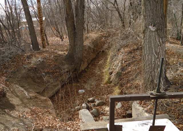
Photographs: Local ditches, 2012; the top three are different segments of the first ditch to run in the spring, the one that feeds parts of the village; the fourth shows a lateral to the left, and the diversion to the property to the right; the bottom is a ditch in a farm field with the dam at the back.
No comments:
Post a Comment