The larger land owners, that is those who owned enough land in La Cañada before the Pueblo Revolt of 1680 to support more than one family, resembled the upwardly mobile in any small community after the Renaissance.
They often are in, but not part of their communities, because they arrive with ambitions, accumulate wealth, often through political connections, and leave when conditions warrant.
The largest land holding after that of the Martín Serrano family belonged to Sebastián González. He apparently was an absentee land owner because Luis Granillo reported “Alonso del Río had possession. Another two families had parts of this hacienda, so three families can fit and settle on this site. Its lands are of better quality.”
According to Angélico Chávez, González didn’t appear in the public record until 1626, when he was described as an alférez (low level military officer) from Portugal. Chávez thinks he could have been the son of Diego Blandín, who was sentenced to join Juan de Oñate in 1598 by the Royal Audencía. Blandín was the son of Diego González from Coimbra, where covert Jewish practices were suspected, according to Stanley Hordes.
González married Isabel Bernal, the daughter of his neighbor next in La Cañada, Juan Griego, but apparently remained in Santa Fé where he and his children rose through the ranks of middling officials.
In 1642 he had was a regent of the colony. One son, Diego González Bernal was alcalde mayor of San Macros Pueblo in 1661. Two years later he as alcalde mayor of Galisteo pueblo, when he supported Bernardo López de Mendizábal against the Franciscans, then fled to Mexico for safety.
In the same year, his brother Antonio González Bernal was acting secretary to the cabildo (governing council appointed by the governor). Others were less conspicuous. Many didn’t return in the reconquest, but some women were trying to regain the property of their mother. One, Melchora Bas González lived in Santa Cruz.
The next largest land owner in La Cañada, Ambrosio Sáez, came from Nueva Vizcaya with his wife, Ana Rodríguez de Anaya. He first appeared in the public record in 1665 in the military in the Sandía area, and later moved north. He was still in the military in 1680.
He, his wife, and ten children made it to Guadalupe del Paso where his son, Agustín Sáez’s wife died. Leonor de Herrera was the daughter of Marcos de Herrera. The family fled the refuge camp for México, although Agustín subsequently enlisted in the reconquest and came north with his new wife, Antonio Márquez.
Santa Fé banished him for adultery in 1701. His daughter, Juliana, married Juan Griego’s grandson. His son, Francisco Sáez, married Juana Herrera of Santa Cruz. Her parents were among the recruits who settled in the villa in 1696.
In describing Ambrosio’s land, Luis Granillo noted that “part of the rebel Tewa Indians from Tesuque Pueblo were camped out here last year, 1694, in order to take advantage of planting the land. For that reason, there are good dwellings. In my opinion, two or three citizens can settle with their families on this hacienda.”
Notes:
Chávez, Angélico. Origins of New Mexico Families, revised 1992 edition.
Granillo, Luis. Report for 12 March 1695, included Blood on the Boulders: The Journals of Don Diego De Vargas, New Mexico, 1694-97, volume 2, 1998, edited by John L. Kessell, Rick Hendricks, and Meredith D. Dodge.
Hordes, Stanley M. To The End of the Earth, 2005.
Tuesday, March 6, 2012
Sunday, March 4, 2012
La Cañada - Hernán Martín Serrano
One is always curious about the people behind rosters like that of La Cañada produced by Luis Granillo in 1695.
Thanks to Angélico Chávez’s work identifying the Origins of New Mexico Families, it’s actually possible to reconstruct a little of the social structure that had evolved between the time Juan de Oñate arrived in 1598 and the Pueblo Revolt of 1680 in the area Pedro de Peralta abandoned in 1610 when he moved the colony of San Gabriel to Santa Fé.
If one uses land holdings alone to rank people, the descendants of Hernán Martín Serrano would have been the most important people in the La Cañada area. They were the only ones who owned an estancia in Luis Granillo’s survey of the abandoned site in 1695. Everyone else either had a hacienda or specified pieces of land. He noted the:
“ruins consist of the walls, which are standing. Five citizens had lived there with their families, settled with their members, since there were sufficient lands and pastures towards the north.”
Hernán Martín Serrano had come with Juan de Oñate in 1598 from Zacatecas as a sergeant under the command of Juan Ruiz. According to family genealogists, his grandfather, Hernán Martín Serrano, was born about 1500 in the Estremadura to Pedro Serrano and Catalina Fernandez, and had come with Hernán Cortés through Cuba as a blacksmith.
According to Robert Himmerich y Valencia, he had the encomienda of Macuilsuchil for a brief time, then the one in Malinaltepec. In the 1550's, he married the widow of Diego Correas, who had come from Cuba with Pánfilo de Narváez to serve under Cortés and had his own encomienda. After he died, his encomienda was reassigned to Luis de Velasco in the 1570's.
Encomiendas were contracts to protect native groups in return for tribute from them in the form of goods and services. Land was not a necessary part of the grant, though nearby land could be assigned separately. They often were given in lieu of salaries owed.
Hernán’s son, Hernán Martín Serrano, was born in 1529 in Guadalajara and moved to Zacatecas where his son, the one who came north with Oñate, was born in 1558. He relocated to Santa Fé where his son, another Hernán Martín Serrano, also resided.
When the son came to the attention of the Inquisition in Mexico City for his involvement with a “woman of low estate” in 1632, he said he was living at La Cañada. In 1664, when he was deposed in the trial of Nicolás Ortiz for the murder of the governor Luis de Rosas in 1641, he said he was an encomendero living in Santa Fé.
His brother, Luis Martín Serrano, was then living on the family land in La Cañada where he had been the alcalde mayor and captain of the Tewa jurisdiction. He had been more involved than his brother in the ongoing battles for power between the Franciscans and the civil governors that probably began before Juan de Escalona wrote the viceroy in 1601 insinuating Oñate should be removed and covertly blessing the desertion of the colony by most of the soldiers and friars.
The governor between 1656 and 1659, Juan Manso de Contreras, was the brother of Tomás Manso, a custodian for the Franciscans. In office, he fathered two illegitimate children. He baptized the girl as a godchild. He and his mistress faked the death of the boy, whom they hid at Luis Martín’s until he could safely be taken to México by the wife of Tomás Pérez Granillo to be raised by Manso.
The next governor, Bernardo López de Mendizábal, fought with the Franciscans and accused Martín of supporting them and having abetted the murder of Rosas by the family of a woman he had seduced. Manos was deputized by the Inquisition to arrest him.
Children of both Hernán and Luis escaped the Pueblo Revolt to return with Diego de Vargas. Some moved to Santa Cruz or married children of their parent’s old neighbors; others moved elsewhere.
Hernán had married three times. Andrés Martín, one of his children with Josefa de la Asención González, inherited his mother’s land in Chimayó, but moved to Alameda by 1734. Cristóbal Martín Serrano, a child of María Montaño, wanted to move to Chimayó, but died in Santa Cruz in 1736. His children by his other wife, Catalina Griego, stayed in Guadalupe del Paso.
Luis’s son, Luis Martín Serrano, had one son who called himself a “a charter settler of the new town of Santa Cruz” in 1713. His son, Antonio Martín Serrano, had wanted to marry Josefa Luján, daughter of Domingo Luján but she preferred Hernán’s son, Mateo Martín.
Luis’s other son, Pedro Martín Serrano de Salazar, lived long enough to return to La Cañada, but was dead by 1700. His daughter, Josefa Martín, married Andrés Archuleta, son of one of the Juan Archuletas. Andrés’ sister, María, married Josefa’s cousin Miguel Martín Serrano.
Pedro’s son, Sebastían Martín Serrano, inherited the spirit of the first Hernán Martín Serrano who rose from blacksmith to encomendero. He married María Luján, who said she was the daughter of Fernando Durán y Chaves and Elena Ruiz Cáceras, and the only survivor of that part of the family massacred in Taos in 1680. Cháves says the names Ruiz and Luján were used interchangeably, but doesn’t identify her place in the family.
Encomiendas were discontinued after the reconquest because their abuses had contributed to the discontent that fed the rebellion. Instead, land grants were made available.
In 1712 Sebastían was given the La Soledad grant of 51,387 acres north of San Juan. In 1714 he was alcalde of Santa Cruz. In 1730 he was in trouble with the governor, Juan Domingo de Bustamante, who ordered him to vacate lands near Taos that were too close to those of the pueblo.
Bustamonte’s reasons for given priority to the interests of natives were no longer religious, but imperial. European wars had been spilling into North America since King William’s War had begun in 1689. His superiors didn’t trust the French, who were trying to use the nomadic tribes as conduits for trade, and wanted to ensure the northern pueblos remained loyal and didn’t receive weapons.
Sebastían sued for damages and lost, but died with real estate in the Taos valley, Truchas and Chamisal.
Notes:
Chávez, Angélico. Origins of New Mexico Families, revised 1992 edition.
Granillo, Luis. Report for 12 March 1695 describing the settlement of La Cañada, included in Blood on the Boulders: The Journals of Don Diego De Vargas, New Mexico, 1694-97, volume 2, 1998, edited by John L. Kessell, Rick Hendricks, and Meredith D. Dodge.
Himmerich y Valencia, Robert. The Encomenderos of New Spain, 1521-1555, 1991.
Wednesday, February 29, 2012
La Cañada - The Site
The first Spanish speaking settlement along the lower Santa Cruz river was known as La Cañada.
It probably evolved from encomiendas granted to men who either settled close to the natives they were supposed to be protecting or sent their agents to the area to collect tribute. Hernán Martín Serrano, the son of an encomendero, says he was living in La Cañada in 1632.
After the Pueblo Revolt of 1680, while the Spanish refugees were living in El Paso del Norte, Tano speakers from the Gallisteo Basin had moved into the settlement, probably to escape attacks by nomadic tribes and to be closer to their kin at San Juan.
When Diego de Vargas agreed to lead the reconquest, he believed he needed more settlers than those who remained in El Paso and requested reinforcements. According to Angélico Cháves, one group of 67 families had been selected by the viceroy, assembled by Cristóbal de Velasco, and brought north by Francisco Farfán. The second group was “recruited in Zacatecas and the Mines of Sombrerete by Juan Páez Hurtado.”
Vargas arrived in Santa Fé with just the refugees to find so much destruction that housing was scarce. When Farfán arrived with his group, conditions were more congested. The arrival of the Zacatecans was imminent when he negotiated with the Tano speakers from San Lázaro and San Cristóbal to move west of the Río Grande, so he could place the overflow population in La Cañada.
On 21 March 1695, his lieutenant governor, Luis Pérez Granillo, and a sergeant related to Miguel Luján, Juan Ruiz Cáceres, inspected the site. To avoid the calamities of 1598, Granillo had been told to locate a place where:
“they may immediately be given a permanent settlement; lands to sow; grass, woods, water, and watering places; ejidos; pastures; and everything they need to raise every kind of cattle, sheep, and goats.”
Coming down from San Juan, they first came to the hacienda of Juan Luis, then the ruin requested by the Tano for relocation.
At the Luis boundary, they found the estancia of the Martínez, who Cháves has identified as Luis Martín Serrano, brother of the above Hernán.
They crossed the Río Grande and, in order, found the property of the following men along the south side of the cañada:
Miguel Luján - hacienda with “lands for agriculture and irrigation” and limited pastures, with a house.
Marcos de Herrera - “suerte and some agricultural fields.”
Nicolás de la Cruz - “lot and agricultural fields” with a house.
Melchor de Archuleta - land for one family, house in ruins.
Juan Griego - suerte large enough to support two families.
Sebastían González - hacienda that had had three tenants, including Alonso del Río.
Francisco Javier - hacienda large enough for two families, the house in ruins and a small torreón.
Pedro de la Cruz - land and one-room house.
They then crossed an arroyo and returned back up the cañada where they found the lands of the following:
Bartolomé Montoya - hacienda with destroyed house.
Diego López - hacienda and torreón, but apparently no house.
Marcos de Herrera - hacienda, with the remains of a house destroyed by the arroyo.
Santa Clara Pueblo - suerte and convento.
Francisco Gómez - hacienda and house foundations.
Ambrosio Sáez - hacienda that could support two to three families with buildings in tact.
Augustín Romero - hacienda and fields.
In total he found land to support 20 families, and more than twice that were expected to arrive from Zacatecas. Some of the original owners no doubt would claim their lands, leaving space in the capital, but potential overcrowding would still exist in both Santa Fé and the soon to be decreed villa of Santa Cruz.
Notes: Cañada apparently referred to the sandy or dry second bottoms of a river, ejidos were common lands, a suerte was an irrigated field, a torreón was a small defense tower.
Chávez, Angélico. Origins of New Mexico Families, revised 1992 edition.
Granillo, Luis. Report for 12 March 1695, included in Blood on the Boulders: The Journals of Don Diego De Vargas, New Mexico, 1694-97, volume 2, 1998, edited by John L. Kessell, Rick Hendricks, and Meredith D. Dodge.
Tuesday, February 28, 2012
The Ditch - Later Contributions
Irrigation improvements, like the settlement of the Santa Cruz valley, did not stop when Juan de Oñate was recalled in 1607 and Pedro de Peralta moved the colony to Santa Fé in 1610. However, it’s difficult to recover the history.
Official sources that survive in México are probably distorted by the legal expectations that governors and alcaldes ensure adequate water resources for land grants. If the 1681 Law of the Indies decreed they provide a “good and plentiful water supply for drinking and irrigation,” then that was what would be in the record.
The reality may have been different. San Gabriel was not self sufficient by 1601 when a Franciscan, Juan de Escalona, wrote the viceroy all the corn the natives “had saved for years has been consumed, and not a kernel is left over for them. The whole land has been reduced to such need that the Indians drop dead from starvation wherever they live; and they eat dirt and charcoal ground up with some seeds and a little corn in order to sustain life. Any Spaniard who gets his fill of tortillas here feels he has obtained a grant of nobility.”
He also notes, without more support from the viceroy, “it will be impossible to live here or remain in ths land, for it is very sterile and cold.” He doesn’t know the years from 1598 to 1601 were “exceedingly dry years” with unusually severe winters. Good rains didn’t appear until 1609.
When you look at the backgrounds of the settlers and soldiers who came with Oñate in 1598 you wonder who among them would have had any idea how to establish a farm, let alone an irrigation system. The roster lists used by Angélico Chávez to compile his Origins of New Mexico Families didn’t give occupation, beyond military status, but they did often list place of birth.
Of those born in Europe, twelve came from Anadalucía, but only one from an agricultural area. Six were from the Basque and Galician north, four from the Estramadura which was cattle country, and four from the area of Madrid and Toledo which also favored cattle. In addition, five came from the Canary Islands where there are no rivers for irrigation.
The others whose origins could be identified were from Mexico City or Zacatecas. José Rivera and Thomas Glick think the last may have been the most important because “they brought with them their rich and diverse experiences with irrigation development in Mesoamerica and the Islamic-Iberian Mediterranean world.”
Oñate’s father, Cristóbal Pérez de Oñate arrived in México City in 1524 from the Basque region of Álava. In 1525 he was given the encomienda of Culhuacan by Cortés and in 1528 the tribute from Tacámbara. After the conquest of New Galicia he was given more land in the area where he founded Zacatecas in 1547 after silver was found.
The mine town imported its food, corn for the Indians and mules, wheat for the Spanish and mestizos. The nearest sources were river valleys on high plateaus where irrigation was possible. Later observers noted that crops in New Galicia were sown in the fall for spring harvest with irrigation, while crops sown in the spring required no irrigation.
The younger Oñate could have learned a great deal about the acquisition and distribution of food from his father, but very little about its production.
After he left, the food supply for the mining towns became more reliable, but also more distant. Records for 1635, the first year for which they are available, indicate Bajío had become the major supplier of wheat, which required irrigation to grow. Landholdings in that area had been consolidated to justify the cost of labor for irrigation. Large suppliers included the Carmelite farms in Salavatierra and Augustinian ones in Celaya and Michoacán.
Almost all religious members were from Europe where concepts for water management had been evolving. After some technological advances in 1570, the Netherlands began massive wetland reclamation projects with improved dikes and canals. Skilled Dutchmen were sought by the Prussians, Swedes, Danes, and French. Anyone interested in advanced farming in those years would have been studying their work.
The most likely diffusion route for new irrigation ideas into the Santa Cruz valley was probably the one group Chávez didn’t mention because they founded no recognized families: the Franciscan friars who were closely associated with the Carmelites in México. It only took the implementation of a few new ideas, like long distance transport and distribution grids, to form the acequia system people remember.
Notes:
Bakewell, Peter John. Silver Mining and Society in Colonial Mexico: Zacatecas, 1546-1700, 1971.
Chávez, Angélico. Origins of New Mexico Families, revised 1992 edition; the ones who came after 1598 were primarily military, those who came with Oñate in 1600 and escorts with the supply trains.
Escalona, Juan de. Report to the Viceroy Regarding Spanish Rule in New Mexico, 1 October 1601, included in George P Hammond and Agapito Rey, Don Juan de Oñate, Colonizer of New Mexico, 1595-1628, 1953.
Himmerich y Valencia, Robert. The Encomenderos of New Spain, 1521-1555, 1991, on Oñate senior.
Rivera, José A. and Thomas F. Glick. “1600 - The Iberian Origins of New Mexico’s Community Acequias,” Economic History Congress, 2002; quote Law of the Indies.
Scurlock, Dan. From the Rio to the Sierra: An Environmental History of the Middle Rio Grande Basin, 1998, on tree ring and climate history, including quotations.
Monday, February 27, 2012
The Ditch - Origins
Impoundment dams like the one on the Santa Cruz river may have been an Anglo introduction to the area, but the ditches have a more cosmopolitan background.
When Juan de Oñate arrived at the confluence of the Chama with the Río Grande on 11 July 1598 with 130 soldiers, their families, some Mexican Indian servants and eight Franciscans, he came with an awareness he needed to build an irrigation ditch. In August, he announced his intent and expected the pueblo he called San Juan to provide the labor.
The Tewa speaking group was divided into two groups, the winter people at Caypa to the east of the Chama who were responsible for hunting, and the summer people at Yunque to the west who were responsible for farming. The ones he called San Juan were the winter people.
When his plans failed to materialize, Bradford Pince says Oñate moved into Yunque with its 400 rooms, and forced the two moieties to share the same space. José Rivera and Thomas Glick suggest all he had to do at Yunque was “reconstruct an irrigation ditch sufficient to irrigate the fields to be cultivated in the fertile valley between the two rivers.”
The San Gabriel ditch still exists as the Acequia de Chamita, although the pueblo is long gone.
Local people were already irrigating the land. However, according to Dan Scurlock, they were flooding their fields directly from the creeks rather than building long distance delivery systems with their grid of laterals and head ditches.
Before they planted in the spring, farmers would bring water through wide, shallow canals. When they needed water later in the season, they would construct temporary dams of brush and logs to back water into the canals.
The methods were adequate for their populations in good years. When there was a short drought, they might make a temporary shift. When the drought lasted more than three years, they began moving to new locations. With the migration of new people into the area, the methods probably weren’t up to the increased demands on the available water.
Rivera and Glick say people commonly look to Spain for the source of local ideas about irrigation. After all, many of the most important conquistadors, as well as some of the original settlers, were from the Estremadura where the Romans built two aqueducts at Merida to support a colony of retired soldiers of the Fifth and Tenth Legions in 25bc.
However, after the Moors conquered the city, Merida was virtually abandoned until the 1500's when people were migrating to the New World. During the Moorish occupation, the area had become more dependent on pastoralism than agriculture.
Moorish irrigation was concentrated in Valencia and Murcia, in the southeastern part of Spain. A number of Oñate’s forces came from Andalucía, but mainly the port cities of Cadiz and Cartaya. The only one from Murcia was Juan de Escarramad.
The more important Moorish contribution was the body of laws governing water, including the idea that water must be made available to everyone, that there were limits on how much people upstream could take, and that communal groups determined the distribution of water through their selected leaders.
When Christians drove Moors from an area of the Iberian peninsula, the rulers usually decreed that people should continue to “irrigate in accordance with ancient custom” or as “established and customary in the times of the Muslims.” The word acequia is derived from the Arab word “sagiya.”
One would guess that under threat of starvation the settlers blended their memories of what they had seen from a distance in México and Spain with the techniques used locally.
Alvar Carlson found construction methods remained primitive into territorial times. An ox was used to begin a ditch by pulling a wooden scraper. Men deepened it with hand tools, dumping the dirt onto the embankments. Dams were made of logs and brush, flumes from hollow logs. Rather than remove large trees, men routed ditches around them and trial and error usually defined the final paths.
It was enough so long as the population remained small. When settlements outgrew the existing resources, the solution was always to send groups looking for new land, first up the Santa Cruz, then along tributaries to the Chama and Río Grande. From Santa Fé they moved south.
Notes: San Juan is now called Ohkay Owingeh.
Carlson, Alvar W. The Spanish-American Homeland, 1990.
Chávez, Angélico. Origins of New Mexico Families, revised 1992 edition, on number and characteristics of men who came with Oñate.
Prince, L. Bradford. Spanish Mission Churches of New Mexico, 1915.
Rivera, José A. and Thomas F. Glick. “1600 - The Iberian Origins of New Mexico’s Community Acequias,” Economic History Congress, 2002.
Scurlock, Dan. From the Rio to the Sierra: An Environmental History of the Middle Rio Grande Basin, 1998.
Friday, February 24, 2012
Santa Cruz Dam History - Part 3

As built by Texas contractors, Chris J Veesaert says the Santa Cruz dam was “unstable seismically.” In a ten-year type flood, the spillway would have been overtopped and the dam would likely have failed in a more serious flood. The Bureau of Reclamation redesigned it to be overtopped safely and built a “stabilizing arched buttress against the downstream face” to prevent failure from “erosion of the intensely-fractured granitic supporting abutment rock.”
They couldn’t do anything about the silt that has accumulated at the bottom, reducing the capacity by 34%. When the district releases 8' of water for irrigation, the lake’s fishing dock is no longer usable. The irrigation district has been trying to increase the height of the dam to the level approved in 1929.
In 2000 Congress allocated $100,000 to study the sediment problem. John McCain protested it was an intolerable earmark.
In 2010 the Corps of Engineers awarded a $291,773.00 contract to the URS Group of Dallas for plans and specifications for the dam restoration project.
When I attended the local ditch meeting a few years ago, the majordomo was optimistic it would soon be shovel ready and funding could be found.
He also commented on potential problems from Chimayó’s tainted ground water. People in the audience began volunteering information that people up there had put their new well next to the dam and was sucking 60% of its water from the dam they still refuse to pay for.
The 1938 Rio Grande Compact between Colorado, New Mexico and Texas limited even more the amount of water people here could use. The dam is no longer simply a source for irrigation water. It’s now part of the regional network that controls the amount and quality of water flowing to Texas.
Whatever its faults and costs, it has to be maintained.

Notes:
US Department of Interior. Bureau of Land Management. Santa Cruz Lake Recreation Facilities Rebuild, Environmental Assessment.
Veesaert, Chris J. 2002. “Addressing Hydrologic Inadequacy” in Dam Maintenance and Rehabilitation edited by J. A. Llanos, J. Yague, F. Sanz de Ormijana, M. Cabrera and J. Penas.
Photographs:
1. Santa Cruz Lake, 14 February 2012; the boat ramp is in the left center.
2. Santa Cruz dam face, 16 February 2012; the buttress addition is on the left.
Thursday, February 23, 2012
Santa Cruz Dam History - Part 2

It’s a fact of life in northern New Mexico, there’s only so much water. Once it was allocated, and it was allocated very early, the only way left to increase agricultural production was to improve the efficiency of the acequias. In 1925, 25% of the water was lost through seepage.
In the 1930's, the Department of the Interior found the Santa Cruz ditch was poorly constructed and required 25 days every summer to maintain. If the Llanos ditch had been straightened, it would have added a square mile to the irrigated land, but landowners who were spending 45 days a summer on maintenance weren’t interested. The Puebla ditch was the worst, built though porous soil, weakened by a nearby arroyo, and requiring 30 to 50 days each summer to repair.
If the ditches couldn’t be improved, John Block reasoned the delivery system could. In 1925, he organized the commercial growers of the Española area into a conservancy district and proposed a dam. With approval guaranteed through his friendship with Tom Burns, who controlled the Rio Arriba county board of commissioners, he got a favorable engineering report from the state.
Based on 8,000 irrigated acres and a 166' dam that would hold 18,000 acres of water, they calculated it would cost $30 an acre to build. The initial tax was $0.69 an acre. They got enough people to join the conservancy to issue bonds for $250,000. Only Chimayó refused in mass, which reduced the number of acres to 5,200.
As commodity prices stayed low in the 1920's, economic conditions deteriorated for both Frank Bond and the people indebted to him. The money for the ditch tax could only come from the cash they got selling their produce to local merchants, and many were too in debt to have any. Bond moved to Albuquerque to find better opportunities near the railroad there. Louis Nohl remained in charge of the local store. W. P. Cook was a trusted assistant.
The investment broker, Sutherlin Barry Bonding Company in Los Angeles, kept 5% of the bond money for themselves, and managed to sell the bonds through their New Orleans office. It was the 1920's and everyone believed the successes of California’s inland valleys could be replicated.
The contractor, Ajax Construction of El Paso, began work in 1926, spent the money in 18 months, built about half the dam and declared bankruptcy. Two other companies put some time into the project, and each of them went bankrupt. By 1928, the annual tax was $2.69 an acre and there were some delinquencies. After some wet years, the summer of 1928 had been hot and dry.
To finish the dam, the conservancy had to issue another $250,000 in debt, sold mostly to the same investors. The tax rate for 1929 went up to $8.36 an acre, just as the national economy was crashing. A severe winter in 1928 had killed half the sheep; floods damaged land in the fall of 1929. Delinquencies soared.

Anderson Brothers of El Paso began work. The bond holders sent a representative who reported $6.00 an acre was the most they could expect the land owners to pay. They began losing money of their investment.
When the dam was completed in 1931, it cost $6,000 more than the contract. It was only 131' high and had one third the projected capacity, 6,000 acres. It had cost $95 an acre to build.
The 1929 and 1930 seasons had been wetter than normal; excess water had damaged irrigation systems. The winters of 1931-1932 and 1932-1933 were severe enough to kill livestock while the summers were so wet flooding was a problem. $40 an acre was later calculated to have been the maximum land owners could afford.
The Conservancy couldn’t pay its debts and went into receivership in 1933. Before the Reconstruction Finance Corporation would intervene, all back taxes had to be paid. The federal bank told the bond holders they would $.25 on the dollar for their original investment, with no interest. An extended drought had begun in 1932.
At this point, Hugh Calkins’ history of the dam gets vague. Some unidentified entity called the Santa Cruz Real Estate and Land Company appeared with Mr. Cook as its agent. When he couldn’t collect the unpaid taxes, he had landowners sign agreements that he would pay their taxes for them, in exchange for rights to their land.
When all the taxes were paid, the RFC took over and sent in its financial people who reported the financial affairs were “pretty much of a mess.” The land company owned 397 acres of land taken from 92 individuals who often “were unaware that their lands had been sold from under them.”

The land company had resold 180 acres to men from Oklahoma and Texas, but it was “doubtful if the money from those sales ever reached the bondholders.”
Once the RFC was in charge, the annual tax was set at $1.00 an acre in 1935 and $2.90 in 1936. Delinquencies dropped. 1934 had been another drought year, but those who still had their land believed enough water had flowed to water the gardens that fed them.
Still, the drought continued and the economy worsened. The government was employing men on its project to clear the Río Grande malaria swamps, but only Leadville was hiring temporary help. A few men went into CCC camps. According to the Department of the Interior, 51% of the men around Española were or had been on relief.
The fortunes of the Bond company faltered. According to Richard Cook, the government price for sheep was half what Bond paid for them. Both Bond and Cook senior were so heavily in debt, they offered their lands to a bank that didn’t want any more unsellable assets. Bond died in 1936, and the family sold the assets and liquidated his holding company. Cook had recovered enough to buy the Española store.
Normal rains returned in 1937.

Notes:
Calkins, Hugh G. The Santa Cruz Irrigation District - New Mexico, 1937; best history of the dam.
Santa Fe New Mexican. “Provider or Destroyer,” 26 April 1998; includes quotation by Richard Cook.
Scurlock, Dan. From the Rio to the Sierra: An Environmental History of the Middle Rio Grande Basin, 1998.
US Department of Interior. Tewa Basin Study, volume 2, 1935, reprinted by Marta Weigle as Hispanic Villages of Northern New Mexico, 1975; best source for social and economic conditions in the Española valley in the 1930's.
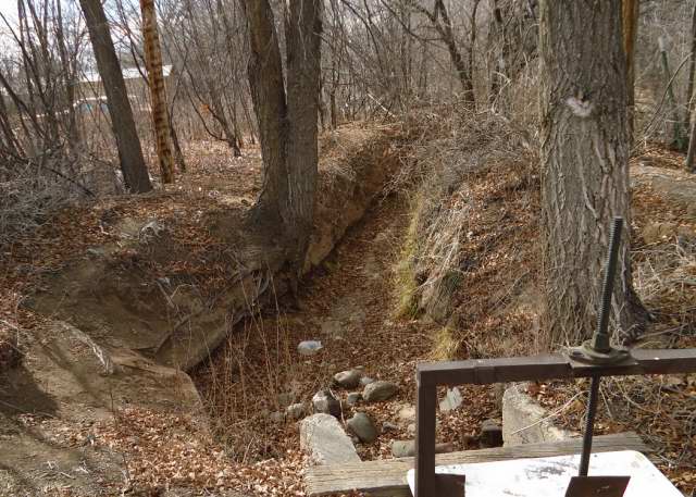
Photographs: Local ditches, 2012; the top three are different segments of the first ditch to run in the spring, the one that feeds parts of the village; the fourth shows a lateral to the left, and the diversion to the property to the right; the bottom is a ditch in a farm field with the dam at the back.
Subscribe to:
Posts (Atom)